Ephraim, Utah. Research Day 10 (July 19).
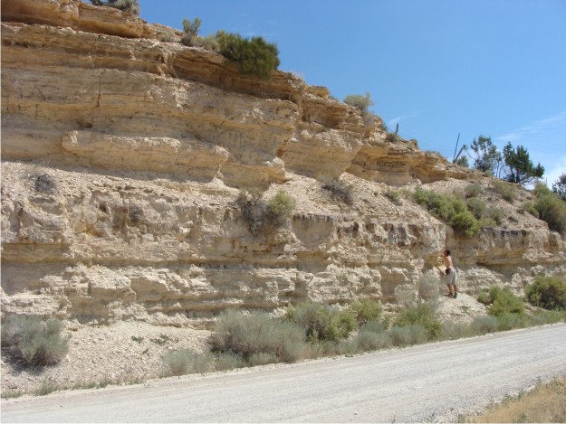
Just a few blocks from where we are staying is a tame elk farm, whose southern border is a very small hill called Gal Hill. As soon as we drove by the hill, we knew that we had hit the jackpot. Most all other exposures of the uppermost large tuff in the Green River are covered by slopewash, but Gal Hill exposes the stratigraphy both below and above the large tuff bed that Bill was mapping in the region with GPS. We decided to spend the greater part of a day at Gal Hill, hoping that it might provide clues to changing lake conditions and facies migrations due to the influx of the tuff.

Scenic overview of Gal Hill, a small hill on edge of Ephraim. In the center of the photo, the larger ledge is the resistant tuff.

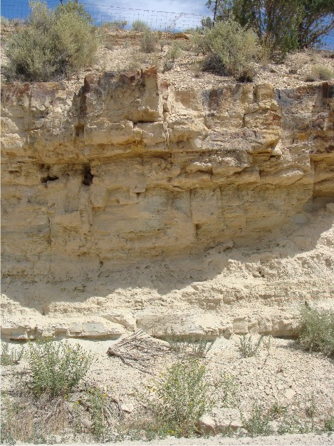
Closer view of the tuff at Gal Hill. At this locality, the tuff is much more planar that at other localities, and it appears to maintain a constant thickness throughout. Immediately below the tuff bed is a zone of silicified stromatolites, some of which have been slightly deformed.

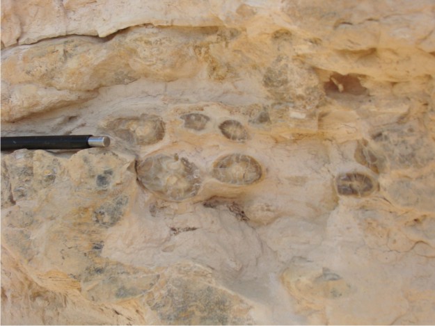
Above the tuff bed, the silica content of the Green River Formation seems to increase, with a variety of chert lenses, concretions, and thin chert beds of various colors.

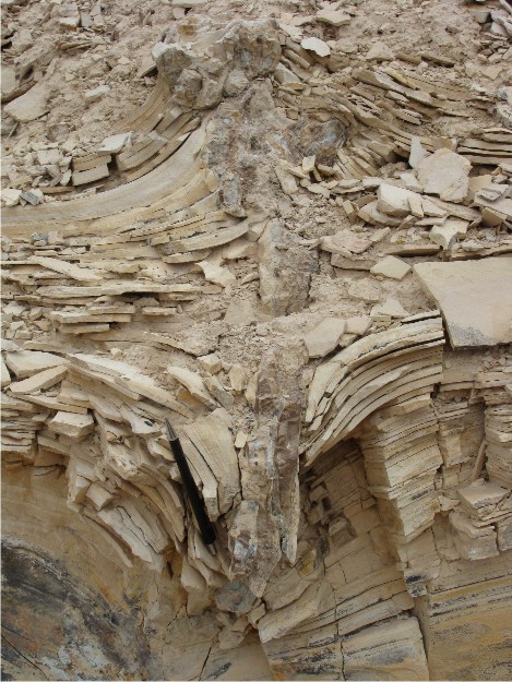
At the top of Gal Hill, the Green River Formation has been bent both downward and upward and fractured, separated by vertical chert lenses.


How in the world did that last structure form? It is as if the strata collided into each other!
The scenery is so gorgeous and crystalline — a wondrous place to work.
You are a blogging machine, Shelley!
The structure appears to be a “boudin” resulting from layer parallel extension with the void created filled by late quartz with a bed normal orientation in the ac plane (least compressive stress). If folding is involved then the fold hinge is in that plane and parallel to So (Bedding to you guys).
Of course I may be wrong but this is the least complex explanation
I’m not a geologist, but I grew up in Ephraim and am very familiar with the areas you’ve explored here. (As a HS student I worked for the Snow College Cafeteria, and fed MANY groups of geologist from Ohio State…)
The strata area on Gal Hill is locally known as “The Cliffs”. We found it a great place to go and look for those chert nodules… the locals called “Cat Eyes”. I have a rock saw and found many of them to be very beautiful. They polish well and can be made into belt-buckles, or other types of jewlery.
I noticed you went to Dry Canyon (west mountains from Ephraim), but have you ever explored Maple Canyon?? It’s north of Ephraim, and NW of Wales. Completely different formations over there.
Enjoy!