


Mary Palmieri’s senior IS was one of the first attempts at using tree-rings to reconstruct cloud cover. A double major in Earth Sciences and Statistical and Data Sciences, Mary was advised by Drs. Wiles and Pasteur.
Abstract: The climate of the Northeast United States has been changing rapidly since the 1970s, and cloud cover poses one of the biggest unknowns in climate modeling. Cloudiness has the potential to influence tree growth, and the temperate forests of the Northeast are poorly understood. In this study, nested principal component regression analysis was utilized to build a reconstruction of June through September (JJAS) cloud cover in the Northeast United States from 1801 to 2002. Ring width data from various oak species and latewood blue intensity data from eastern hemlock (Tsuga canadensis) were used to create a time series that explains at most 43.18% of the variance in average Northeast JJAS cloud cover. The reconstruction suggested that cloudiness in the 1800s and early 1900s was primarily forced by volcanoes and widespread deforestation. After the 1950s, cloud cover changes were dominated by rising sulfate aerosol and greenhouse gas emissions. Shifts in the 1920s and 1970s were likely intensified by coeval changes in the Atlantic Multidecadal Oscillation and Pacific Decadal Oscillation, respectively. High summer cloudiness is associated with less dense hemlock latewood and wider oak annual rings. However, precipitation has a more direct effect on tree growth than cloud cover. Hemlock trees are most impacted by decreased light availability and cloud-induced temperature changes, whereas oak trees are primarily limited by moisture. This study lays the groundwork for future paleoclimatic reconstructions of cloud cover using tree rings and provides a better understanding of Northeast temperate forest climate interactions, which will be integral given the uncertainty clouds pose in the wake of modern climate change.
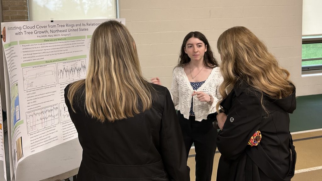
Mary describing the results of her work during the senior IS Symposium.
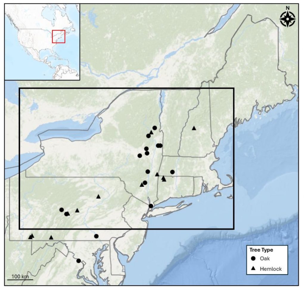
Map showing the locations and correlations of the 30 chronologies used in the modeling. These all have significant correlations at the 95% confidence level with 1906 to 1973 average JJAS
cloud cover inside the region bound by the black rectangle.
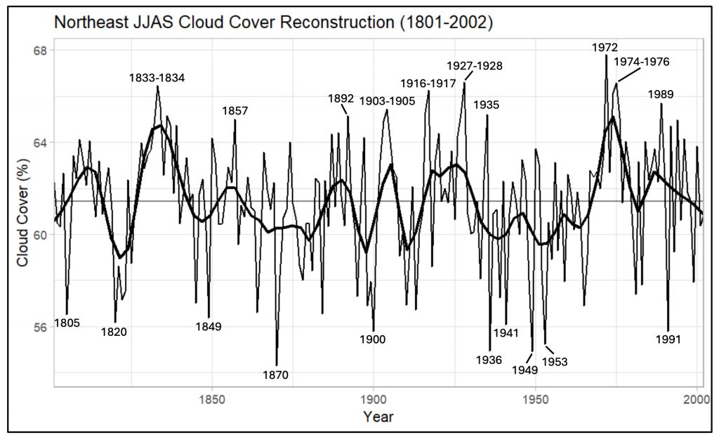
Northeast JJAS cloud cover reconstruction in percentage from 1801 to 2002. Both the original reconstruction and a smoothed version are shown. The top ten highest and lowest cloud cover events are labeled with the respective years. The horizontal line indicates the mean.
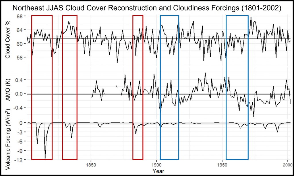
JJAS Northeast cloud cover reconstruction, JJAS AMO, and annual global volcanic forcings from 1801 to 2002. Horizontal gray lines indicate the mean. The red boxes highlight time periods where volcanic eruptions may have influenced cloud cover, and the blue boxes show when the 35-year running correlation between the cloud cover reconstruction and the AMO was significant at a 95% confidence level.
Congratulations on finishing an excellent thesis, Mary! Clouds and cloudiness are notoriously difficult to model, as you know well. You used some intricate statistical tools to sort out the historical effect of cloudiness on tree growth. This statistical experience will serve you well in the future.
You’re in the last class of students I knew well at Wooster. I miss you all very much. I wish I could attend your commencement, but I’m now so far away. Best wishes for your post-Wooster plans!