


SLIPPERY ROCK, PA – I’ve just returned from the March meeting of the Pittsburgh Geological Society. If you’re in the region and you’re not a member, you really should think about joining. On the third Wednesday of each month, a robust group of faculty, students, and professionals gather for a social hour followed by a tasty meal and a geo-talk. I was honored to have the opportunity to speak about my passion for basalt geochemistry and was fully impressed by the friendly, engaged audience. The questions from the students, in particular, were clever and insightful. (Attention potential employers: the PGS is your regional source for the next crop of professional geologists).
The PGS also runs field trips, and my host, Dr. Patrick Burkhart, took me on a tour of glacial features near his home institution of Slippery Rock University.

A google map image of the glacial features near Slippery Rock, PA. The numbers correspond to the images below. (Imagery from DigitalGlobe, GeoEye, USGS, USDA Farm Service Agency).
We began our trip at the Jacksville Esker (also known locally as the West Liberty Hogback or Miller Esker), which may be the best-preserved esker in Pennsylvania (Fleeger et al., 2003). The >6 mile-long esker is an elongate, sinuous ridge of sand and gravel that was deposited about 23,000 years ago by meltwater in a subglacial tunnel (Fleeger and Lewis-Miller, 2009).
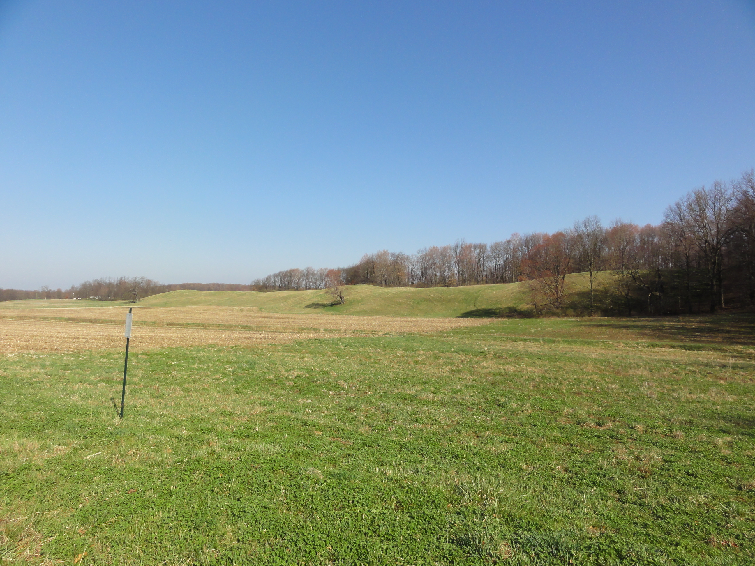
Photo #1: View of the elongated ridge formed by the Jacksville Esker.
Adjacent to Jacksville Esker is Tamarack Lake, an ecologically important wetland. We viewed Tamarack Lake from Swope Road, which cuts through the esker, and noticed a school of trout in the water near the road. I imagined that they were enjoying the warm spring day.

Photo #2: View of Tamarack Lake from Swope Road.

Photo #3: Trout enjoying the warm water at Tamarack Lake.
Jacksville Esker ends in the Kame Delta, which formed in a proglacial lake. Sediment in the delta is generally well-sorted, ranging from fine sand to cobbles, and is currently being mined by the Glacial Sand and Gravel Company (Fleeger and Lewis-Miller, 2009). We didn’t get to tour the quarry, but according to the field guide, mining has exposed crossbeds, ripples, and multiple foreset beds that suggest that the delta was built by a series of depositional events (Fleeger and Lewis-Miller, 2009).
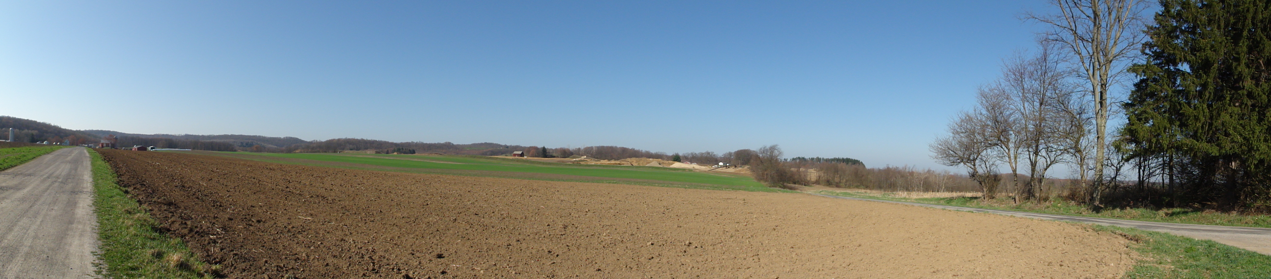
Photo #4: View of the relatively flat-topped Kame Delta. The gravel mining operation is located near the center of the photo.
We saw a few other things on the trip, but I think I’ll save those for another post.
References:
Fleeger, G. M., and Lewis-Miller, Jocelyn, 2009, Stop 7: Jacksville esker, delta, lake plain, and drainage diversion complex, in Harper, J. A., ed., History and geology of the oil regions of northwestern Pennsylvania. Guidebook, 74th Annual Field Conference of Pennsylvania Geologist, Titusville, PA. p. 146-159.
Fleeger, G. M., Bushnell, K. O., and Watson, D. W., 2003, Moraine and Mc- Connells Mill State Parks, Butler and Lawrence Counties—Glacial lakes and drainage changes: Pennsylvania Geological Survey, 4th ser., Park Guide 4, 12 p.
That esker is fantastic — and so was the March weather!