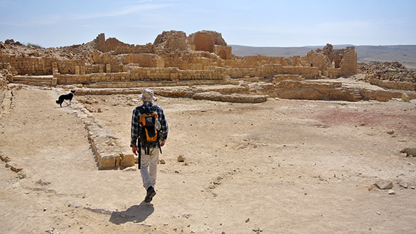
 MITZPE RAMON, ISRAEL–The tradition we’ve built over the years on our Israel expeditions is to travel to interesting places on Saturdays to take a break from work. Yes, it appears geologists never really stop geologizing, but then that’s not really “work”, is it? Today Yoav, part of his family and I went to the Nabatean-Byzantine city of Shivta to explore the ruins and ponder the role of geology in the development of the settlement. You can find Shivta on the map at N 30.88185°, E 34.62878°. This site was studied by several archaeologists over the years, but I’m most impressed by the visit of T.E. Lawrence here in 1914. (Yes, that Lawrence.)
The questions: Why did this city develop here off the main routes? Did climate change force the abandonment of this city along with many other Negev settlements? Obviously we’re just poking around with these, but Yoav has some really good observations.
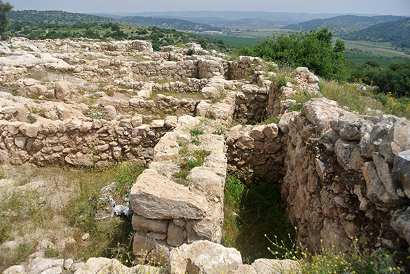
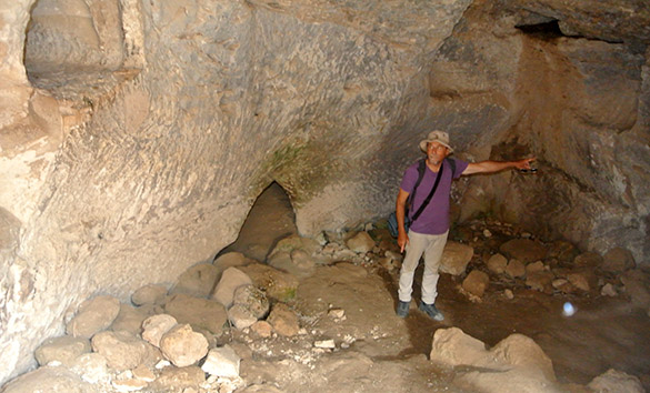
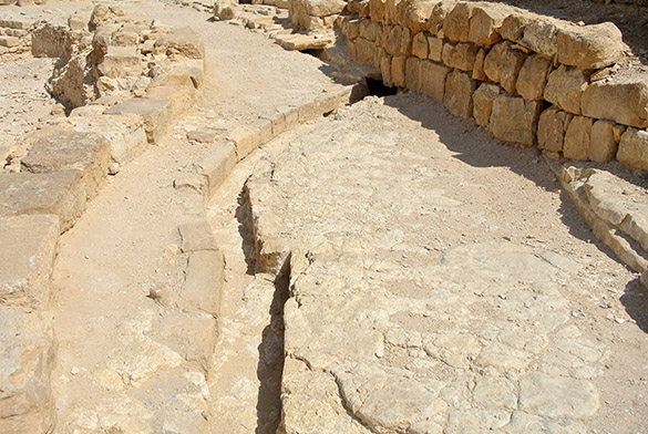 Obtaining enough water in this very dry place would have been the first problem to solve. The area has a limestone bedrock that the inhabitants could cut and carve to make many channels to direct storm rainwater into cisterns for storage and use during the dry seasons. Here we see a channel cut directly into the bedrock floor of the city plaza. At the top of the image are rock slabs covering the channel. They would have extended for the whole length to reduce evaporation.
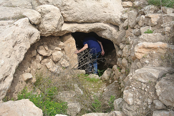
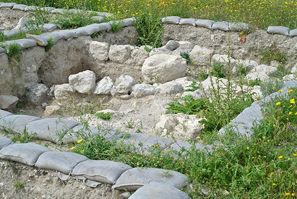
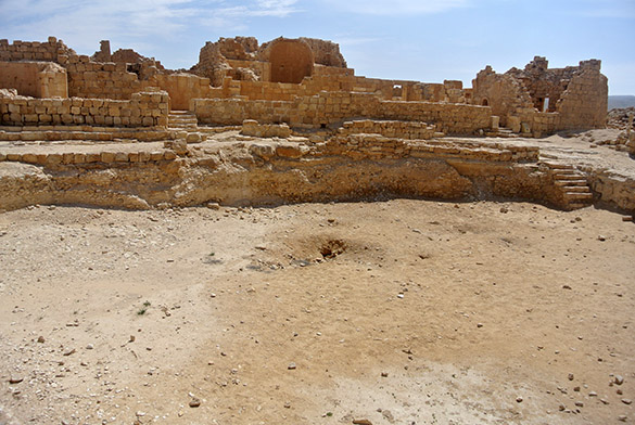 That drainage channel, and many others, leads to this large cistern in the center of the town. It is mostly filled with sediment now. During its use it was many meters deep and had plastered walls to reduce leakage. Archaeologists have calculated that enough water could be stored in this cistern and many others through the city to support the population. This is with present rainfall amounts (about 10 cm a year). These cisterns could be easily built because about a meter below the hard limestone is a soft sandstone that can be excavated quickly.
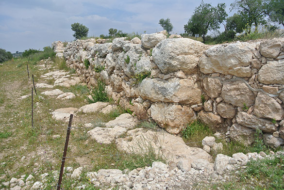
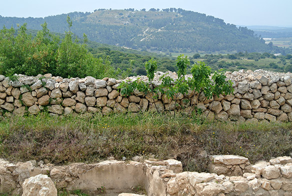
 The building stones for Shivta were obtained in the city itself and a few dozen meters away. Here is one of the ancient quarries. The limestone can be split vertically and horizontal slabs removed for use. You thus only have to cut the stone in two dimensions rather than three.
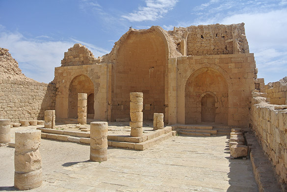 This is the beautiful Southern Church. It has a classic Byzantine design. The interiors were made with soft Eocene limestones that could be easily smoothed and carved, while the rougher limestones were used for support out of sight. Some fragments of facing marbles, imported from Italy, can be seen in the alcoves.
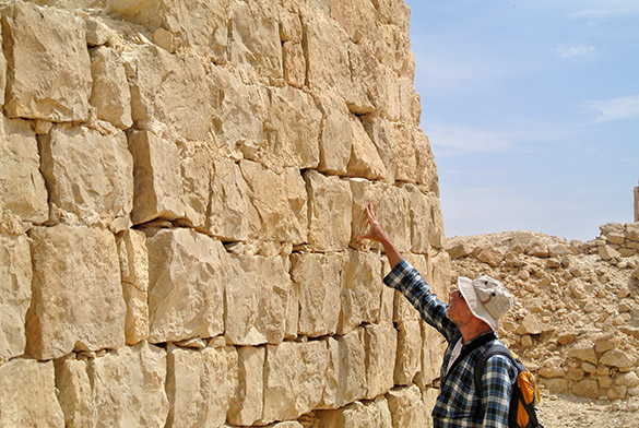
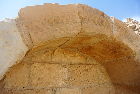 The stone above is fine-grained Eocene limestone suitable for carving. The stone in the background is coarser limestone. This is a portion of the Southern Church.
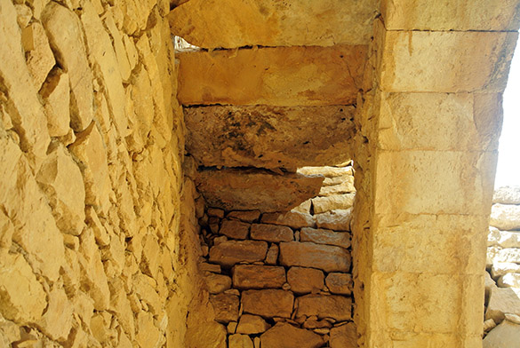 Wood is a rare material, so the roofs were made of stone slabs laid across stone arches. Yes, you can imagine the earthquake danger!
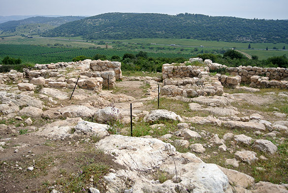
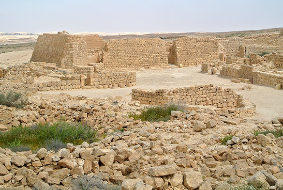 The larger Northern Church is in the background here. Note the thick, sloping walls, especially on the left side.
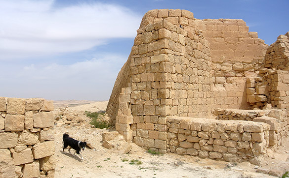 In this closer view of the walls (and the Avni family dog, Anicha — great outdoor dog!), we see that the bulk of them are made of the rough limestones, and they were constructed to buttress the failing original walls, a smooth portion of which can be seen in the top right. These buttresses were made after earthquakes destabilized the finished walls.
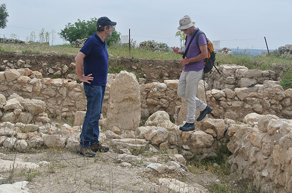
 Yoav is pointing here to further earthquake damage to the buttresses themselves. The Shivta people lived through several earthquakes and continued to reinforce their structures.
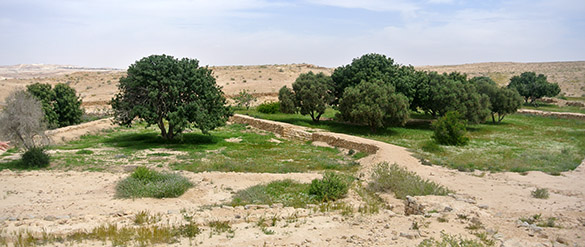 To the north of the city is this spectacular garden. It is an experimental plot to see if economic plants like olives, carob and pomegranates can be grown with just the local water trapped in basins in the Byzantine manner. The experiment ended years ago and the plants are doing great.
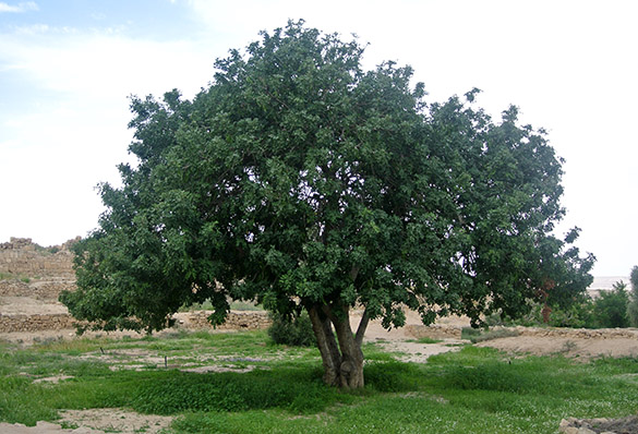 This is a carob tree (Ceratonia siliqua), which is an important source of food and medicine throughout the Mediterranean region. Clearly it does well under these circumstances.
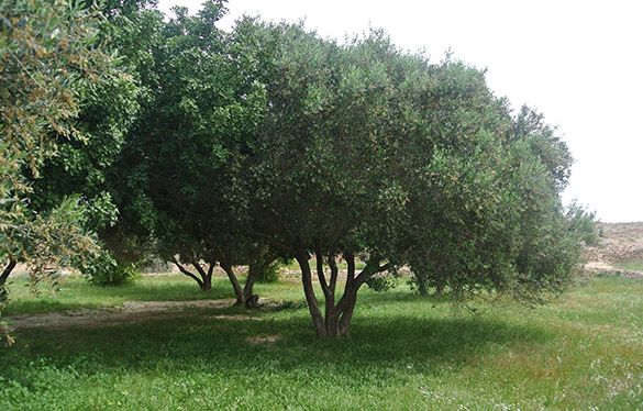 These are olive trees, with a field of wildflowers beneath. With present rainfall amounts enough water can be trapped for agricultural and domestic use in Shivta. The hypothesis that some sort of desertification event (a common idea) ended these desert settlements is difficult to support when the dry conditions of today can still support the original community. It was likely economics and politics that spelled the end of Shivta, not climate change. We also see how critical the local geology was to the early inhabitants of this isolated city. They chose the location well for the agricultural and economic conditions of the time.


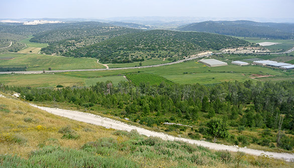
 MITZPE RAMON, ISRAEL–Pesach (Passover) begins this evening at sundown, but essentially the holiday has started today as people prepare for this evening’s family seders. The town has gone very quiet as stores have closed and traffic dropped to almost no vehicles moving. I spent the day walking around the periphery of Mitzpe Ramon enjoying the beautiful weather and occasionally making some accidental geological observations. As you can see from above, it doesn’t take long to leave the city and enter The Wilderness.
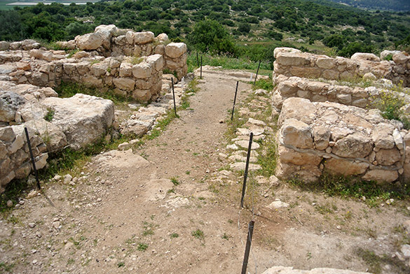
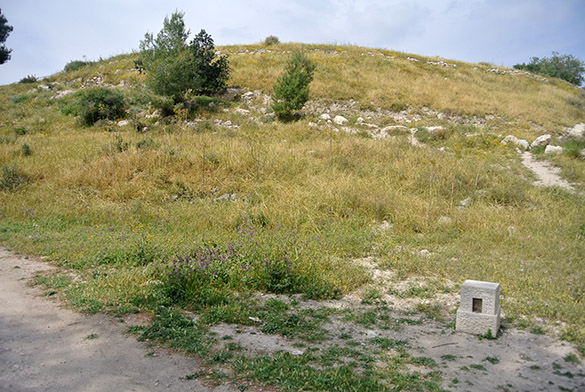
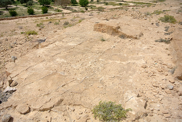
 This is a small archaeological site on the western end of town. I don’t know much about it, other than it is likely Iron Age. Israeli archaeology students often map it for practice.
 A view of the western end of Makhtesh Ramon because … why not?
 This feature is called The Camel for obvious reasons. It perches on the edge of the makhtesh and has long served as a beacon for a route in and out of the makhtesh. An observation platform has been built on it as a “saddle”. The units here are the En Yorqe’am at the base and the camel itself made of the dolomitic Zafit Formation.
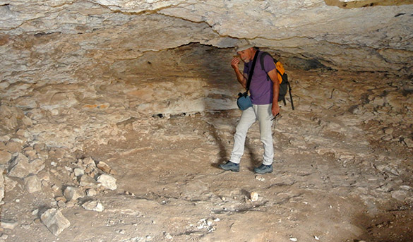
 I took advantage of the quiet to visit a housing development and check out the problematic muddy dolomitic unit near the base of the En Yorqe’am.
 Finally, I met this young, friendly Nubian ibex (Capra nubiana), one of hundreds that calmly wander the streets here. He was happily eating bread slices that had been thrown out in preparation for Pesach.