


 MENDOZA, ARGENTINA–Today I had one of the finest geological field trips in my life. The scenery was stunning, the geology extraordinary, and the history deeply moving. Being able to share the experience with so many of my geologist friends, old and new, was a bonus. I also thought how much my Wooster Geology colleagues would have enjoyed this excursion. There were volcanics for Meagen, glacial deposits for Greg, and the most extraordinary structural geology for Shelley. This was a mid-meeting field trip of the Fourth International Palaeontological Congress entitled “Darwin and the Highest Andes”. It was led by Victor Ramos and Laura Giambiagi.
The purpose of the trip was to explore the Central Andes from Mendoza almost to the border with Chile, cutting a cross-section through the ranges. We followed the route Charles Darwin took between March 29 and April 5, 1835. This experience was heaven for me: history and geology combined.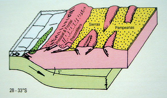 The above image is from Jordan et al. (1983, issue 3 of Episodes) reproduced in our guidebook. It shows the flat-slab subduction beneath the Andes as well as the three ranges we visited (Precordillera, Frontal Cordillera, and Principal Cordillera). We traveled from right to left on this diagram perpendicular to the mountains.
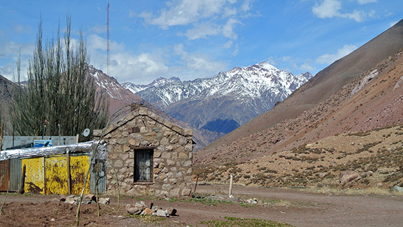
 The Precordillera was impressive enough by itself. Here is the dirt road we followed up the eastern slope. It is an enlarged mule path used for centuries as part of the road between Chile and Argentina. Most famously this is the route General José de San Martín used in his epic 1817 Crossing of the Andes to defeat the Spanish as part of the Wars of Independence. Charles Darwin, of course, took the same route in 1835.
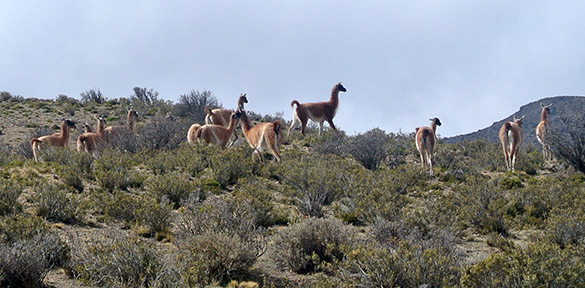 We saw many guanacos (Lama guanicoe) on the way up into the mountains. These camelids native to the area have delightful black faces and skittish ways.
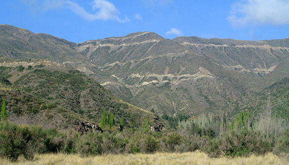
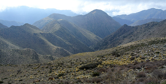 Looking west across the Precordillera near the top. The clouds we see stayed around the Mendoza area, but we were above them and had a wonderful sunny day.
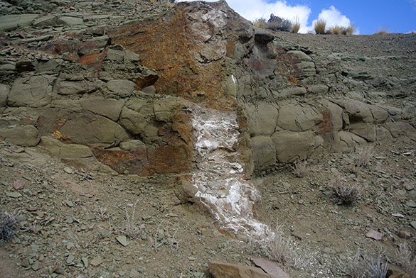 Our first major stop was at a petrified forest in Triassic rift valley sediments. Darwin described these tree trunks, which are coarsely replaced by calcite, as part of a buried conifer forest that had been tilted to the west. The sediments are mostly fine volcanic grains. He counted 52 trees, but I found only a few during our stop.
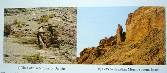 Darwin wrote that one of the fossil trees reminded him of “Lot’s wife turned into a pillar of salt.” Who could guess that one of my photographs from Israel would make it into the guidebook as a consequence!
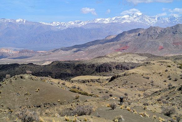 The view west from Darwin’s Forest shows the beginning of the Frontal Cordillera. The terrain here is very much like that of the Mojave Desert in California, even including a species of Larrea (creosote bush).
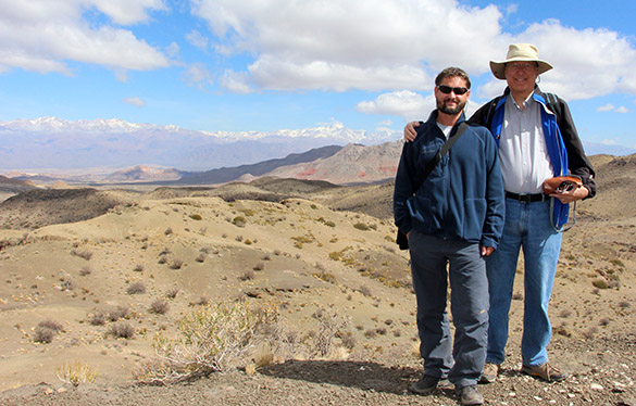 My Polish colleague Michał Zatoń and me with the magnificent Frontal Cordillera. Thank you Michal Rakocinski for the image.
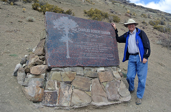 Here I am at a plaque honoring Darwin at the fossil forest. An earlier marker had been destroyed by a small group of local Creationists. Evolution is not very controversial in Argentina, but some of their Creationists are apparently vandals. This plaque has been made especially thick and heavy.
 We ate lunch while admiring this view of Triassic volcanics near the start of the Frontal Cordillera. The stone work is the Picheuta Bridge.
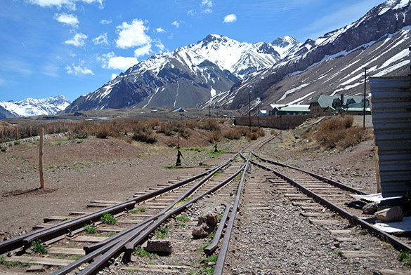 We are now in the Principal Cordillera of the Andes. I’m looking along old railroad tracks at Puente del Inca into the magnificent High Andes.
 This is the opposite view. Note the fine, fine weather. We needed only light jackets or sweaters.
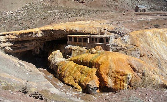 Puente del Inca itself is a natural bridge of travertine-cemented landslide debris. Thermal springs like these are scattered along the axes of the Principal Cordillera of the Andes. This bridge, sadly, had nothing to do with the Incas, although they did extend this far south.
 Darwin drew a cross-section of the Principal Cordillera, including this site at Puente del Inca (on the middle right). This is an image from the guidebook of our trip.
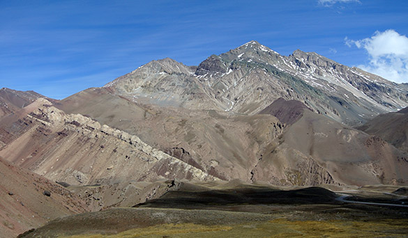
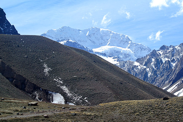 The most impressive part of our trip (I’m avoiding “high point”!) was this view we had of Aconcagua, the highest mountain in the southern and western hemispheres. Essentially it is Miocene volcanic rocks unconformably atop folded Cretaceous sedimentary deposits thrust on top of Paleogene rocks. This iconic mountain often has snow blowing off its crest, producing white clouds. Darwin mistook these for ash emissions and thought this was an active volcano.
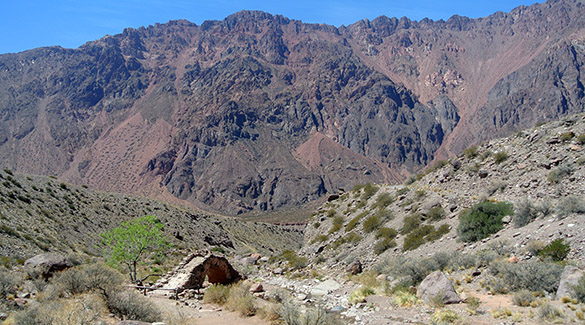
 Our last stop was at Casuchas del Virrey, a brick structure built in 1765 for Spanish officials making the hazardous trip between what would become Chile and Argentina. (They would have rather communicated by sea through the Magellan Strait, but the British were making that difficult.) Darwin himself stayed here, so this little building is often called “Darwin’s Shelter”. The doorway is so high because of the accumulation of snow here in the winter.
 Thank you to Victor Ramos for being such an effective, knowledgeable, humorous and patient guide for this trip. He is a structural geologist, but also quite good with sedimentology, paleontology and history. He made this excursion one we will long treasure in our memories of the Andes. Thank you also to my Wooster colleagues for making this trip possible for me.
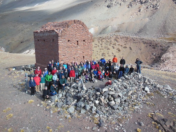 (Late update, October 4th: Field trip group photo courtesy of Beatriz Aguirre-Urreta.)
Mark- what a treat!…thank you for this post..must have been really inspiring to walk in the footsteps of Darwin.. awesome geology!
Thanks, Suvrat. The Andes are a highly recommended destination point for geologists! Good luck with your own work.
Pingback: The Amniotic Egg: Amphibians to Reptiles (October 13-17) | History of Life course at The College of Wooster
Pingback: Phylum Mollusca: Our friends the gastropods and the cephalopods (October 14 & 16) | Invertebrate Paleontology at Wooster