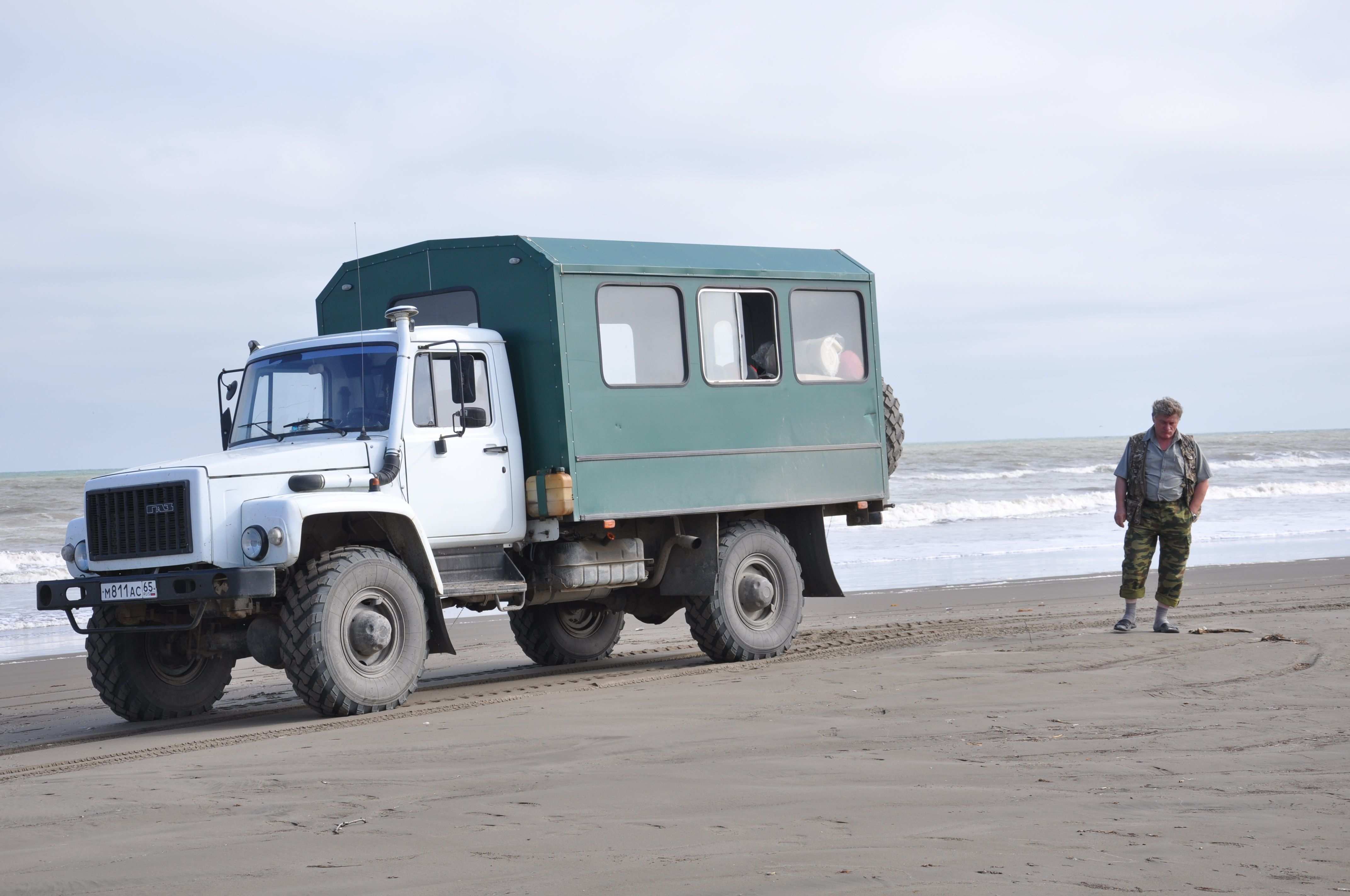
WOOSTER, OH — Two months in the field is great for my geologic soul, but I admit that there is an excitement on campus as I prepare for classes to begin in the next few weeks. I last blogged about my time in Utah weeks ago, when Tricia Hall (’14) and I collected data in central Utah for her I.S. project on deformation bands. It was difficult for me to blog while teaching field camp in June and July (32 students; 24/7 questions), but I wanted to catch everyone up on some of the sights from this summer.
During our last days in the field together, Tricia and I were both geologists and naturalists, witnessing “survival of the fittest” first-hand. Check out these action shots:
 This snake has caught a bat, which was hiding in one of the fractures in the rock. Oh…by the way…we just so happened to be taking measurements in this very area!! As I was taking measurements, my head came within inches of the snake’s rear end. But, lucky for me, he didn’t see me, as he had shoved his head inside one of the fractures to grab the bat. Needless to say, when I saw our friend, I broke the world record for the 100 m dash (well, it was more like the steeplechase as I bounded across the rocks).
 Our friend ate several bats that afternoon; you can see here that he is busy swallowing one of the bats completely. But, we still had to grab data, so I sent Tricia back in to get some of the measurements!! As the diligent advisor, I decided to be “on the look-out” while she took the measurements (placing Tricia between the snake and me).
After my time with deformation bands, I spent time in Ice Springs Volcanic Field with ‘Team Utah 2.0’ (Meagen Pollock, 6 Wooster geology students, and a group from Albion College led by Thom Wilch). Meagen did a great job blogging our exploits of our field season, which was definitely enjoyable!!
Then, for the rest of the summer, I taught at Ohio State’s field camp based in Ephraim, Utah, and field camp this year had a record number of students. While I cannot show you pictures of our mapping areas and tell you about all of the really outstanding geology there (after all, I don’t want to spoil the fun and give away all of the answers for next year’s students), I will say that central Utah has some amazing geology. The field camp is located in the Sevier fold-thrust belt, and so wonderful foreland basin deposits are the basis of many of our mapping areas. However, the area has been overprinted by more recent extension, making it a very complex transition between the Basin and Range and the Colorado Plateau.
I would like to share with you some of the really awesome field trips that we took the students on…
 Early on, we traveled to Capitol Reef National Park, where the view of the Waterpocket Monocline is phenomenal. The structure is one of the classic monoclinal folds formed during the Laramide Orogeny. But, even though I absolutely LOVE monoclines, there was more to see at Capitol Reef…
 Here is a picture of the Navajo Sandstone and its amazing cross-bedding in all of its glory. Can you just imagine yourself standing in this large desert environment during the Jurassic? Picture yourself as a sand grain, saltating along a dune surface…
 But, I cannot forget to show you a picture from the Goosenecks Overlook in Capitol Reef. Seeing the stratigraphy in this portion of the part was very helpful to all of the students, as they began to mentally correlate units from southern Utah toward central Utah.
After days of mapping back in central Utah, we took another field trip to Great Basin National Park and the Northern Snake Range (eastern Nevada); this trip with the field camp students is always a highlight for me each summer.
 At Great Basin National Park, you can take a guided tour of Lehman Caves. Some of the views inside of the caves are incredible. The delicate and fragile cave morphologies are spectacular and include stalactites, stalagmites, draperies, shields, and popcorn!! The added plus to the Lehman Caves tour is that the temperature is always in the 50s, which is such a contrast to the desert heat that I am in all summer.
From Great Basin National Park, we traveled to the Northern Snake Range…
 The Northern Snake Range, seen above, reveals a remarkable metamorphic core complex (MCC). A MCC is a result of extreme crustal extension, and so you can see highly metamorphosed basement rocks that have been exhumed.
 Above is a scenic view of the Northern Snake Range detachment surface (NSRD; note the white rock unit in the picture). The detachment surface is really a low-angle fault, which reveals metamorphosed rock in the footwall and normal faulted units in the hanging wall.
 Here is a look at the highly folded metamorphosed rocks of the NSRD. It literally takes the field camp class hours to walk a transect through all of the rock units leading up to the NSRD, but once they get there, the view is well worth the hike. This year, we were able to have an amazing view of a forest fire in the Great Basin National Park (Lexington Arch Road wildfire, July 2013).
After a day looking at the NSRD, it was time to examine some other extensional characteristics of this region…
 Take a look at all of these conjugate, normal faults near the mouth of Hendrys Creek!! Aren’t they absolutely beautiful? We were able to take the class up close and personal to these faults, getting accurate measurements for a computer-based exercise for later in the summer. Students were able to take joint and fault measurements at this locality and foliations and lineations at several other localities within Hendrys Creek. Then, using Stereonet, they could analyze and interpret the tectonic significance of the area!! I get to visit Hendrys Creek each summer, and one of my former I.S. students (Joe Wilch ’13) worked in Hendrys as part of his I.S. project with the summer 2012 Keck Geology Consortium.
At the end of the summer, it was back to mapping in central Utah, and this — mapping and teaching mapping — makes me very happy. I just love to be out in the field. Each and every day, I get to look at the magnificent Wasatch Monocline with its fantastic Mesozoic-Cenozoic stratigraphy and antithetic normal faults (shown below in a view up Manti Canyon).

IT IS GREAT TO BE A FIELD GEOLOGIST!!


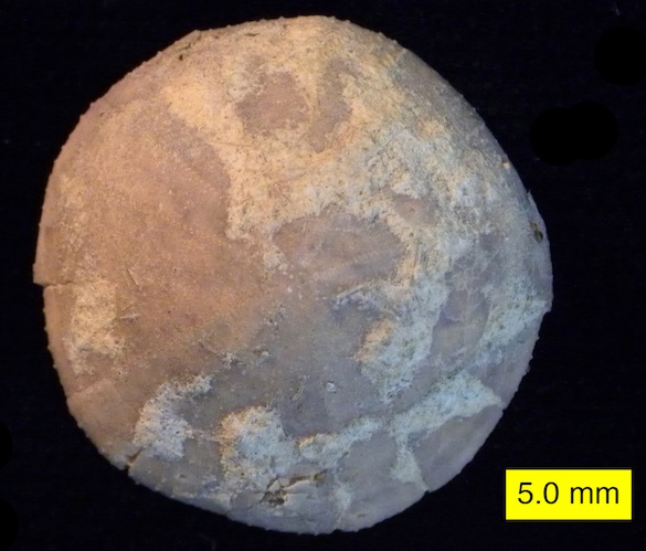
 On a recent field trip to Sicily, our paleontological party visited outcrops at Cala Sant’Antonino on the western side of the Milazzo Peninsula in the northwestern part of the island. We saw there an Early Pleistocene sedimentary unit informally called the “Yellow Calcareous Marls”. With a handlens you would see a close view of the rock like the image above. It consists almost entirely of tiny hollow white spheres with occasional dark flecks. In the lab back home these little calcitic balls were revealed to be tests (skeletons) of foraminiferans known as Globorotalia inflata (d’Orbigny, 1839). This is a classic example of a biogenic sediment called foraminiferal ooze, samples of which are now in Wooster’s paleontological and sedimentological teaching collections.
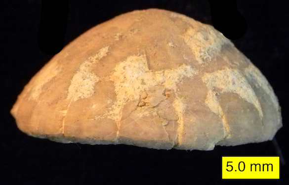
 This is the outcrop of the “Yellow Calcareous Marls” at Cala Sant’Antonino from which the above samples were collected. The rock is very soft and powdery to the touch.
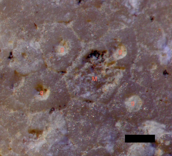
 In this closer view of the rock the individual foraminiferal tests are more apparent. Near the center is one example showing the connected bulbous chambers (making it multilocular) and the slit-like aperture between them. These tests are slightly recrystallized, giving them a sugary look. The dark bits are sand-sized volcaniclastic grains derived from early eruptions of the Mount Etna complex.
 These are modern examples of Globorotalia inflata. (The scale bars are 0.1 mm.) The bumpy surface texture, bulbous chambers and distinctive aperture make identification of the fossil examples fairly easy. The images were taken by Bruce Hayward.