


Hello to you all from… still McMurdo. While we’re all frustrated to still be playing the waiting game, a ray of hope appeared last night – a plane flew from McMurdo to WAIS Divide, for the first time in over two weeks! Furthermore, three planes (a Basler and two Twin Otters, in case you’re interested in planes) are en route with cargo today from WAIS Divide, with destinations at Lower Thwaites Glacier (a staging site for gear headed to the science camps), Cavity Camp (our first destination) and Grounding Zone (the first camp for the MELT team). In fact, we just found out that the Basler successfully made the first landing at Cavity Camp, and has brought a whole bunch of our cargo – Ted and Erin literally both just did cartwheels in celebration.
Unfortunately, the delays, along with some aircraft maintenance issues, mean that we’re not going to achieve all of our original science goals, at least this season. But with the latest big gains, we should still be able to get a whole lot of good science done. It’s possible I could now be leaving for the deep field as early as Friday (fingers crossed!), so I wanted to make sure to slip in one more blog post for you all before I go.

Locations of historic huts on Ross Island, from https://www.coolantarctica.com/schools/Antarctica-maps-ross-island.php.
A few years ago I got into reading many of the great polar exploration stories of the early 1900s. If you’re interested in some great reading, start with Alfred Lansing’s “Endurance” about Ernest Shackleton’s failed attempt to cross Antarctica between 1914 and 1917. Another brilliant classic, this time a first-person account, is Apsley Cherry-Garrard’s “Worst Journey in the World” about Scott’s 1910-1913 Discovery Expedition to the South Pole. And if you want to come closer to understanding the true depths that a human being can suffer, Lennard Bickel’s “Mawson’s Will,” about an ill-fated expedition to map the Antarctic coastline south of Australia, will give you a new appreciation for what early polar explorers have endured.
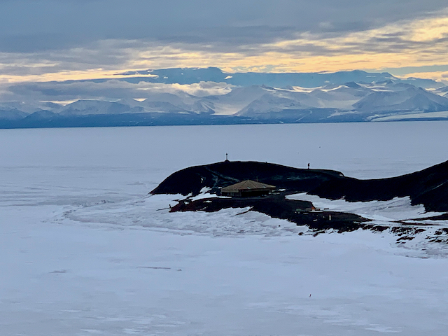
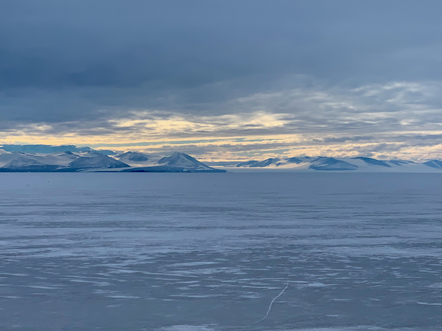
A view of Hut Point from behind my dorm, with the Discovery Hut in the foreground and Vince’s Cross near the tip of the point behind the hut.
Since I have some knowledge of these epic exploration stories, and some personal experience with icy locales, one of the most exciting aspects of McMurdo for me is the nearby historical sites. Ross Island has played host to many historic expeditions, which left three huts that still stand along the shoreline. Scott’s Discovery Expedition built the first hut at Hut Point in 1902.The Nimrod Expedition, the first expedition Shackleton led to the Antarctica, left a hut at Cape Royds in 1908. And Scott’s 1910-1913 Terra Nova expedition left a hut at Cape Evans. Unfortunately, with the thin sea ice this year, we won’t get to visit the huts at Cape Royds or Cape Evans, but Hut Point is visible from my dorm building and is just a few minutes’ walk down the road. You can’t go in on your own, but we arranged a tour for our whole team last week.
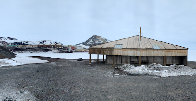
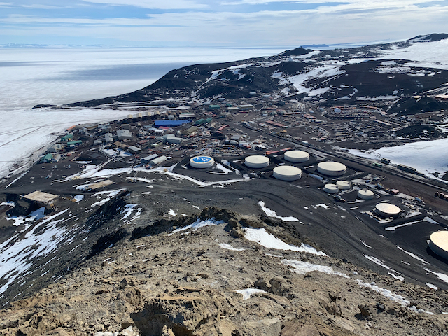
The Discovery Hut with McMurdo in the background.
Captain Robert Falcon Scott’s Discovery Expedition (1901-1904) was primarily focused on mapping and carrying out scientific research. It included many men who played key roles in later expeditions, such as Ernest Shackleton, and made many important discoveries, including finding the Dry Valleys (the only ice-free valleys in Antarctica).
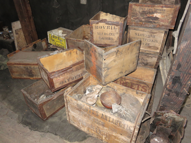
Crates piled inside the Discovery Hut.
They also learned a thing or two about huts. The hut they put up at Hut Point was a pre-fabricated hut that was actually designed for the Australian Outback. As Australia is known for heat, not cold, the hut was designed to be shady, cool, and well-ventilated. As you might imagine, that’s not ideal for Antarctica. The men found the hut to be cold and uncomfortable, and chose to mostly live and work aboard their ship (the Discovery). The hut was used primarily for storage, as well as for some cooking and science.
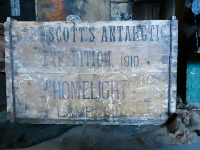
A box from Scott’s 1910 Antarctic Expedition.
Despite its drafty interior, it was still a valuable shelter and equipment cache for later expeditions. Shackleton’s Nimrod expedition used the hut briefly in 1909, on their way back from an attempt to reach the pole. Scott’s 1910-1913 Terra Nova expedition used the hut (which was farther south than their hut at Cape Evans, making it a good jumping-off point for south-going parties) fairly extensively. The last people to use the hut were the Ross Sea Party of Shackleton’s Imperial Transantarctic Expedition, who left in 1916. It then lay untouched (and full of snow and ice), until it was dug out in 1956, the year McMurdo was founded.
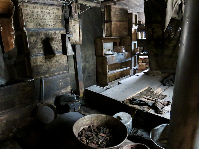
The kitchen area inside the Discovery Hut.
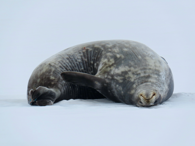
The hut remains well-preserved today. I walked over to see the hut on my own not long after I arrived. I was engrossed in reading the sign on the door (which just indicates rules for entry), and suddenly jumped when I realized I was standing right next to a dead, decaying seal dating from 1916. When we got to go inside the hut, we found a high-ceilinged, open interior that had been curtained off into a main storage/living area and a kitchen area. There’s also one separate room, which was used primarily for carrying out scientific experiments and analysis. Artifacts inside are very well-preserved (other than a slowly decaying pile of seal blubber), and have been arranged for better viewing. There are crates, bags, and shovels from the expeditions, old tin cans and tools, and even some pieces of the biscuit that was a staple of their diet (I wouldn’t try eating it now!). You can faintly see on the walls where many of the men wrote their names.

Tools and supplies inside the Discovery Hut.
Just up the hill from the hut, out on the end of the point, is a cross that was erected in 1902 in memory of a Discovery crewmember who drowned near that spot.
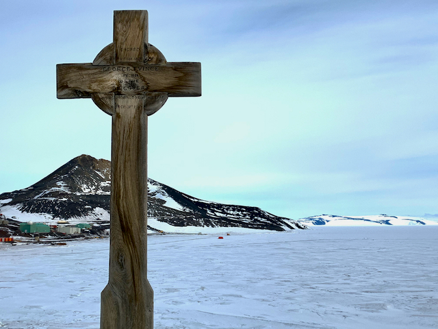
The cross the Discovery Expedition erected at the tip of Hut Point in memory of George Vince.
Although the Discovery Hut is perhaps the most interesting historical site in the immediate vicinity of McMurdo, Scott’s 1910-1913 Terra Nova Expedition is much more famous. After several expeditions had made attempts, Scott was determined that a British man would be the first to stand on the South Pole. They made extensive depot arrangements and used a variety of techniques to get there, including ponies, man-hauling, and some experimentation with the earliest motor sledges. Five men from Scott’s expedition reached the pole on January 17th, 1912, only to find that the Norwegian Roald Amundsen had beaten them by just five weeks (incidentally, Amundsen is arguably also the first to reach the North Pole, as earlier claims are disputed, and he led the first expedition through the northwest passage). Still more tragically, Scott’s team never made it back; one of the men died on the march, one walked into a storm to sacrifice himself as he knew he was dying and was holding back the team, and the final three, Scott included, died in a blizzard in their tent, just 11 miles from a major supply depot.
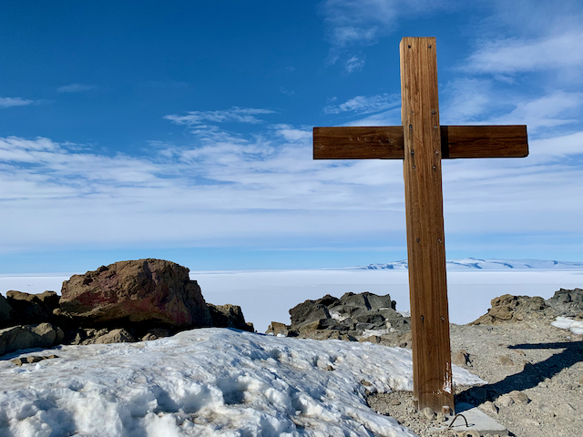
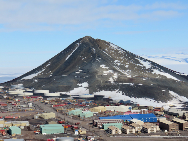
The cross the Terra Nova Expedition erected at the top of Ob Hill in memory of the five men who lost their lives on the way home from the South Pole.
Before heading home, the remaining members of Scott’s expedition erected a cross at the top of Observation Hill to honor the lost pole party. They inscribed it with the names of the lost and a line from Tennyson’s Ulysses: “To strive, to seek, to find, and not to yield.” The inscriptions have all but worn away by now (you can still see faint impressions if you look closely), but the cross still overlooks McMurdo.
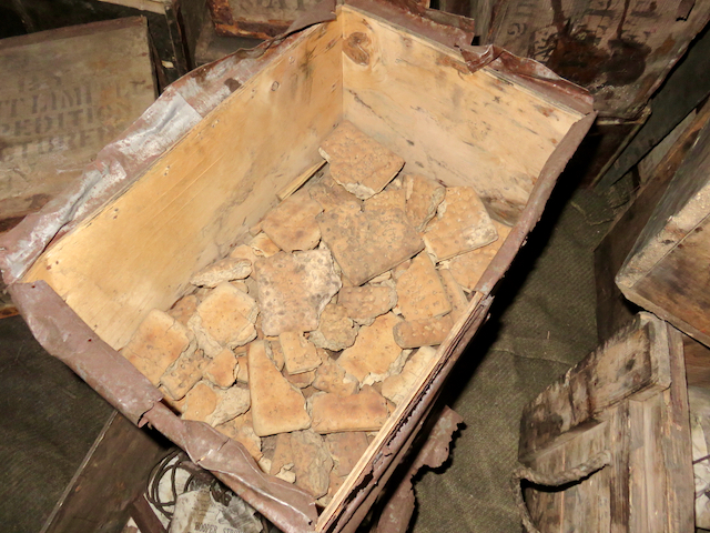
Biscuit left by one of the expeditions at the Discovery Hut.
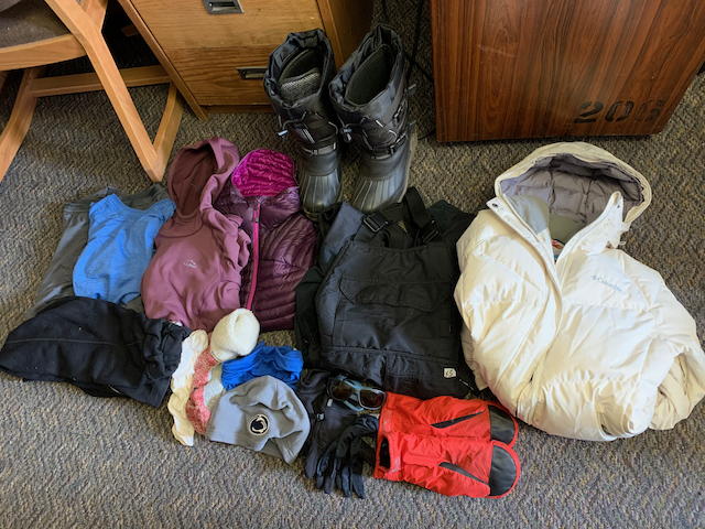
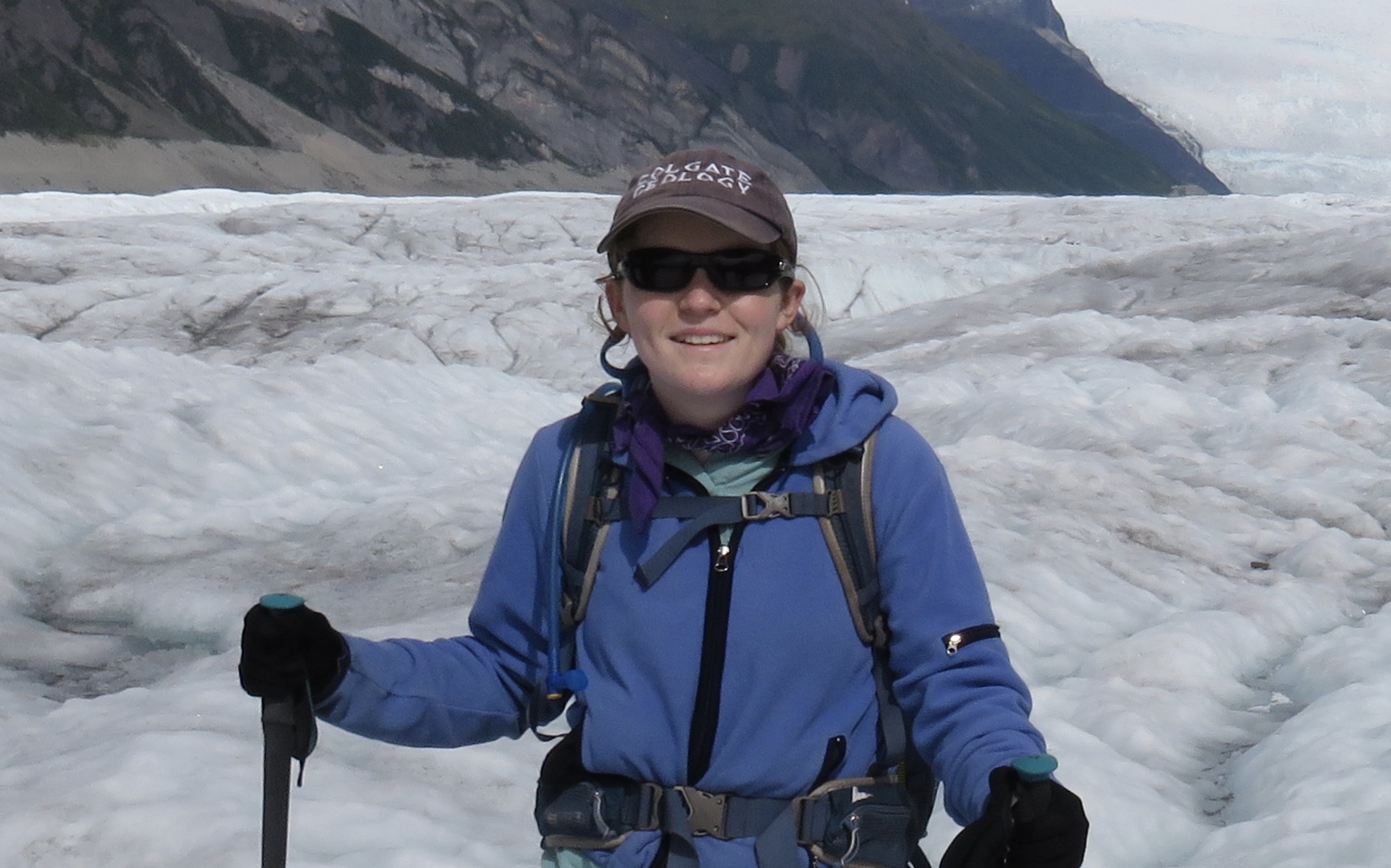
Having spent a little time in the middle of the Greenland Ice Sheet, and being about to head out to West Antarctica, I can’t imagine the bravery and outright craziness it must have taken for early explorers and researchers to achieve what they did. I’ll be sleeping in a fluffy synthetic sleeping bag on two insulating pads; they had reindeer fur sleeping bags that sometimes began to rot partway into the expedition. We have high-calorie, high-protein, and mostly good-tasting meals and snacks, including a whole lot of chocolate; they survived on biscuit, pemmican (basically powdered meat mixed with fat and sometimes other ingredients), and often their dead sled-dogs. We’ll be back to the comforts of home in just a couple months, and in the meantime have several forms of communication with McMurdo and with home; they went away for several years with hardly any communication at all during that time. We may be facing a harsh environment in the field, but it’s a heck of a lot easier to face than it was 100 years ago!


