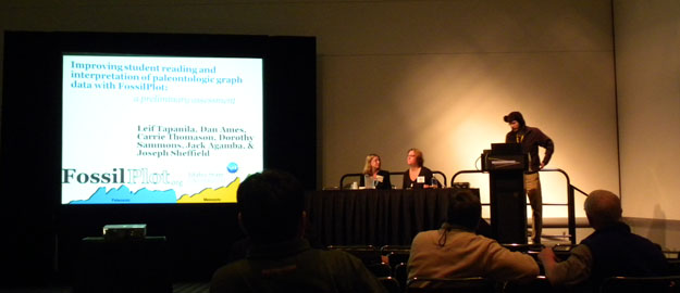
Last stop in Europe: The Senckenberg Museum of Natural History

FRANKFURT, GERMANY–Isn’t that a great front yard for a Natural History Museum? Diplodocus longus strides by columnar basalt and a massive chunk of conglomerate. This is the Naturmuseum Senckenberg in downtown Frankfurt, about two blocks from my hotel. On my last day in Europe I met with Dr. Mena Schemm-Gregory, a brilliant young paleontologist who specializes in brachiopods. I was very impressed with the labor-intensive way by which she makes three-dimensional reconstructions of brachiopods embedded in matrix, including their internal structures. I also simply enjoyed the museum displays. This is a good way to end this eventful trip — a visual survey of the history of life!

The front of the Senckenberg Museum, which was built in the first decade of the 20th Century. The tall object on the left is a life-sized reconstruction of a Carboniferous seedless vascular plant. I'm cleverly using it to hide an annoying smokestack in the background!

Close-up of a massive piece of Banded Iron Formation also standing outside the museum. This one is anywhere from 3.5 to 1.9 billion years old. It represents a complex interaction of ancient microbes, seawater and the atmosphere which is still not completely understood.

Even the living plants highlight life's history. This is a branch of a ginkgo tree, a group which has an ancient lineage extending back to the Triassic. Er ist ein "Lebendes Fossil".

Posted in Uncategorized | Tagged , , | Leave a comment

Palisade Falls in Hyalite Canyon, Montana

Today, we ended the indoor classroom portion of the Teaching in the Field Workshop with a lively discussion on the use of technology in the field. Everyone seemed to agree about its usefulness in research; however, there were many different views when the discussion turned to the use of technology in the field when teaching students how to map. Digital mapping is used by state geological surveys and the USGS, but the techniques are not universally used in the classroom and in field camps across the country. When this friendly debate was concluded, it was time for dinner. Instead of eating in the conference room in the student union, the workshop coordinators had organized a picnic for us overlooking Hyalite Reservoir.

Hyalite Canyon is located just south of Bozeman in the Gallatin Range, and it exposes rocks of all ages — Archean gneisses through Eocene volcanics. Before dinner, we hiked to Palisade Falls for a spectacular view that underscored the fact that I was definitely not in Ohio.

As we walked to Palisade Falls in Hyalite Canyon, we followed a wonderful stream flowing through a sub-alpine forest.

As we walked to Palisade Falls in Hyalite Canyon, we followed a wonderful stream flowing through a sub-alpine forest.

Palisade Falls, shown above, was gorgeous during the early evening light.

Palisade Falls, shown above, was gorgeous during the early evening light.

Notice the wonderful columnar jointing that makes up the wall for Palisade Falls.  It was very difficult to pull 50+ geologists off of this outcrop, but dinner was ready!!

Notice the wonderful columnar jointing that makes up the wall for Palisade Falls. It was very difficult to pull 50+ geologists off of this outcrop, but dinner was ready!!

The rest of the week, the workshop on Teaching in the Field is actually taking to the field to put boots on the ground.

Posted in Uncategorized | Tagged , , | 3 Comments

Summer coming to an end…

Guest Blogger: Jesse Davenport

Dear Meagen and Shelley, I hope you both like extremely sheared metamorphic and igneous 2 billion year old rocks because I have about 100 of them coming to Scovel in about a week.

But really I have had an amazing time in Montana and am sad to see my time out west coming to an end, yet I am happy to be returning home after 3 months of travel. I would have liked to update you all a little more often on what has been happening in Big Sky country, but the internet situation and the communication in general is rather limited.

On our daily traverses we encountered diorite, tonalite, mica schist, marble, mylonite, amphibolites, quartzite, and Yellowstone related volcanics (although we weren’t particulary interested in these). We saw many signs of wildlife both actually seeing and other signs. Cattle sightings were especially common, but we also saw elk, antelope, moose, golden eagle, bald eagle, badger, marmot, ferret, fox, and hawks. Unfortunately, in my opinion, we didn’t see any bear but all the locals tell us they are there black and grizzly.

There is still a lot of work to be done even though field work is over. We came into the project with some general questions, but now we have the data, the rocks, and the field observations that we need to make a significant scientific contribution to the understanding of the geologic evolution of the area. This project marks a pinnacle achievement in the area which has had very little work done and is already misunderstood in the scientific community geologically speaking.

I am looking forward to working with Meagen and Shelley on my project and taking the opportunity that the Keck Consortium COW Geology Department gave me to produce a significant piece of scientific literature.

Our field area, Antelope Basin.

Our field area, Antelope Basin.

A view of Saddle Mountain.

A view of Saddle Mountain.

Some nicely sheared rocks in an outcrop in Antelope Basin.

Some nicely sheared rocks in an outcrop in Antelope Basin.

Posted in Uncategorized | Tagged , , , | 1 Comment

Fossils on the Meuse-Argonne Battlefield

Cretaceous oysters in marly sediment near Baulny, northeastern France.

VIENNE LE CHATEAU, FRANCE–To my delight, while exploring the Meuse-Argonne area this morning, I found an exposure of marly Cretaceous sediments very near where my Grandfather’s tank brigade assembled for an attack at dawn on October 4, 1918. The sediment is poorly consolidated and saturated with water, as expected. Mud again — the same mud that must have been an annoyance and danger to those nervous tank crews that October morning.

The Cretaceous marl in a roadside outcrop near Baulny, France (N49.25672°, E5.01696°).

Some of the fossils from today cleaned up in the hotel room. (They must hate it when I do this.)

The fossils are small oysters, and they are there by the thousands. The only other species I saw were serpulid worm tubes attached to their upper valves. When found in place the oysters are articulated (both valves still in place). The facies is very similar to that of the Paleocene Clayton Formation we saw earlier this summer in Mississippi.

Could Rolland Snuffer, an 18-year-old corporal from Kansas, have imagined that 92 years later one of his grandsons would be collecting fossils in this war-ravaged place? I think he would have been very pleased. His experiences here must have been horrendous. He was the gunner/commander of a two-man FT-17 Renault tank in a unit which took heavy casualties during this action.

Corporal Rolland Snuffer was in Company C of the 345th Tank Battalion attached to the First Division. North is at the top. Map courtesy of Brad Posey.

The village of Fléville today (from N49.30578°, E4.96945°).

The village of Exermont then and now.

Corporal Rolland Snuffer in an undated family photograph.

There were over 117,000 American casualties, including 26,000 dead, in the Meuse-Argonne battle, with about the same number for the Germans and another 70,000 French dead and wounded. This was the most costly battle ever fought by Americans. Our losses were far less than those suffered by our European cousins, but we still shared with them the profound effects of this war on a generation. It is hard to imagine this peaceful French countryside convulsed by war, but then it happened again 22 years later. That must have been a bitter pill for the veteran Doughboys to swallow after they survived the War to End All Wars.

A book on the battle I highly recommend: To Conquer Hell by Edward G. Lengel (2008, Henry Holt and Company).

Posted in Uncategorized | Tagged , , , , | 5 Comments

Battle of the Mines: Vauquois, 1915-1918

Mine craters on the Butte de Vauquois, northeastern France.

VIENNE LE CHATEAU, FRANCE–The influence of geology on war is shockingly clear on the Butte de Vauquois (N 49° 12′ 20.20”, E 5° 4′ 11.42”). This large hill (290 meters in elevation) is an outlier of the chalky detritic sandstone (silicarenite) [thanks, Jean-Claude Porchier] backbone of the Argonne Massif, with the small village of Vauquois originally on the top. (That “originally” should give you a clue to what’s coming.) It had immediate strategic value in September 1914 when the invading German Army captured it and began to shell French supply routes to Verdun running alongside the Aire River. The French desperately wanted it back.

The French Army attacked the Butte de Vauquois with thousands of men several times. Since they lacked the strategic advantage of topographic height, they suffered enormous casualties, only capturing the southern side of the hill in March 1915. The top, with its ruined village, became a no-man’s land.

The French then began building mine tunnels through the dry and stable bedrock towards the German lines. Soldiers from coal-mining areas were employed to dig caverns underneath the German trenches. These excavations were then filled with explosives and ignited, creating massive craters on the surface which troops attempted to exploit. The Germans, who employed over 100 military geologists in their ranks, responded with their own tunnels and explosions under the French lines. Eventually almost 25 miles of tunnels riddled the Butte de Vauquois, with each side building explosive caches and attempting to intercept the enemy tunnels. An astounding 531 French and German mines were exploded here by September 1918, splitting the hill in two parts with a row of craters. The destruction was so immense that the village of Vauquois completed disappeared. Thousands of soldiers on both sides were killed here, with 8000 completely missing and presumably buried in collapsed tunnels and trenches.

A tunnel constructed in 1916 from the French trenches into the Butte de Vauquois.

This hellish underground war finally ended in September 1918 when the American First Division bypassed the hill during the first day of the Meuse-Argonne Offensive and the Germans retreated. To this day only a few of the Vauquois tunnels have been reopened. There is still much unexploded ordnance in the mines, and no one wants to disturb what has become a massive tomb.

Google Earth view of the Butte de Vauquois, with north at the top. The chain of craters through the middle of the hill is obvious. The tiny white dots on the southern edge of the craters near the middle of the image include the monument pictured below.

French monument to the dead on Butte de Vauquois. It stands where the village of Vauquois was completely erased by the underground war.

Posted in Uncategorized | Tagged , , | 4 Comments

Sacagawea Peak in the Bridger Range

The entire group at the On the Cutting Edge Workshop (Teaching Geoscience in the Field) spent a few hours in the field talking about various teaching strategies. Our field site for this exercise was the Bridger Range, and we climbed to Sacagawea Saddle. Fortunately, on the climb up, Terry Pavlis (structural geologist at UTEP) gave me a Trimble Juno with ArcPad to use so that I could try this digital mapping technology out in the field once again.

The view from Sacagawea Saddle was gorgeous, and we had a great conversation about teaching pedagogy at the top.

View of the Paleozoic carbonates that are wonderfully exposed along the climb toward Sacagawea Saddle.  This area is in the Gallatin National Forest.  Notice the huge talus pile and the remnant snow in the photo.

View of the Paleozoic carbonates that are wonderfully exposed along the climb toward Sacagawea Saddle. This area is in the Gallatin National Forest. Notice the huge talus pile and the remnant snow in the photo.

The photo above illustrates the magnificent view that you have from the Saddle. (View to the west)

The photo above illustrates the magnificent view that you have from the Saddle. (View to the west)

View of Sacagawea Peak from the Saddle.  All of the rocks in the photo are the Paleozoic carbonates, which straddle the entire spectrum from lime mudstones to wackestones to packstones, grainstones, and boundstones.  It was fantastic for me to walk through this thick Paleozoic sequence that had been caught up in thrusting and was now exposed in the Bridger Range.  (By the way, Dr. Wilson, there sure are some great fossils here!!...Tabulate corals, rugose corals, brachiopods, crinoids, stromatoporoids, and yes -- even some bryozoans.)

View of Sacagawea Peak from the Saddle. All of the rocks in the photo are the Paleozoic carbonates, which straddle the entire spectrum from lime mudstones to wackestones to packstones, grainstones, and boundstones. It was fantastic for me to walk through this thick Paleozoic sequence that had been caught up in thrusting and was now exposed in the Bridger Range. (By the way, Dr. Wilson, there sure are some great fossils here!!...Tabulate corals, rugose corals, brachiopods, crinoids, stromatoporoids, and yes -- even some bryozoans.)

Posted in Uncategorized | Tagged | 1 Comment

Another Wooster Geologist in Montana

In an earlier blog, Jesse Davenport (2011) described some of this experiences this summer while working on his Keck project in Montana. Jesse is still in SW Montana, although his official last day in the field is August 16. He should have plenty of great geology stories to tell from his time out here in Big Sky Country.

Speaking of Big Sky Country…
Earlier this month (August 8), I also came out to Montana State University to attend two On the Cutting Edge Workshops. The first workshop (August 8-11) was called “Using GIS and Remote Sensing to Teach Geoscience in the 21st Century”. This workshop has revolutionized the way that I will teach GIS in spring 2011, and it also has contributed to significant changes to other courses that I teach in the curriculum. I am so glad that I was able to participate with other faculty from all over the country who teach GIS and Remote Sensing courses.

The second workshop, which I am still participating in this week, is called “Teaching Geoscience in the Field in the 21st Century”. I love teaching in the field, so this workshop will help my activities each year with our I.S. program and with field camp. In fact, I gave a presentation on Wooster’s I.S. program twice to the audience of geologists, and it seemed to be well-received. There is definitely some commonality between capstone courses at various institutions, but there are some distinct differences, too. For example, no other school boasts of an I.S. Monday in which the Registrar dresses as a Tootsie Roll and the Dean dresses in the MacLeod tartan!!

In between each workshop, we spent a day in the field in which we were shown several different uses of technology in the field. I was able to play with (1) a tablet PC that ran GeoMapper software, (2) a toughbook that ran ArcMap, (3) a Trimble Juno that ran ArcPad, and (4) a GeoClino that allows simultaneous measurements of strike and dip (of bedding) and trend and plunge (of a lineation) within seconds!! The day was fantastic, because you typically do not get to try so many different digitial mapping technologies in one setting.

Posted in Uncategorized | Tagged | Leave a comment

The military advantage of holding the Upper Cretaceous chalk highlands

Upper Cretaceous chalk exposure in the gloomy Argonne Forest.

VIENNE LE CHATEAU, FRANCE–There is one strong geological control of warfare in northern France: the high areas are often thick, resistant Upper Cretaceous chalk while the valleys and plains below are usually poorly-consolidated greensands and clays. We’ve already seen these remarkable chalks this summer in Mississippi, Israel, and Germany. Cretaceous Chalk is nearly global in its extent (The White Cliffs of Dover in England and the Chalk Buttes of Kansas are made of it) and it tells us that there was something very different in oceanic chemistry and biology compared to today.

The Argonne Massif is a range of chalk hills running roughly north-south with the Aisne and Aire Rivers cutting through it, along with many smaller streams. The Champagne-Ardenne/Lorraine regional boundary runs through the long axis of the massif. In World War I the Germans occupied most of the highlands in the north since capturing them in 1914. They built relatively spacious and dry bunkers and trenches in the chalk, whereas the French and then later the Americans were mostly confined to the unstable clay-rich lowlands. The most bitter battles here were over the possession of key high points, and the geology of the rocks and soils was a critical factor in success or failure.

The Argonne Massif covered mostly by forest. North is at the top of the image.

Posted in Uncategorized | Tagged , , | 2 Comments

Wooster Geologist in France

Landscape near Vienne le Chateau, France.

VIENNE LE CHATEAU, FRANCE–I’m on the last part of my European trip this summer. The International Bryozoology Association post-conference field trip ended in Frankfurt yesterday. I rented a car at the Frankfurt airport and drove southwest into northeastern France where I will spend three days. I am visiting the World War I Meuse-Argonne battlefield to find those places where my Grandfather fought in the 345th Tank Battalion of the American Expeditionary Force (September and October, 1918). I hope to have posts related to the geology of the battlefield and how it affected events. I am staying in a small hotel in the Argonne Forest (N 49.19130°, E 4.88281°), so I’ll have plenty of time to explore.

An overgrown World War I entrenchment near my hotel.

Posted in Uncategorized | Tagged , | 2 Comments

The Messel Fossil Pit: A world-class experience

FRANKFURT, GERMANY–Last year at this time I had the privilege of visiting the Middle Cambrian Burgess Shale on an expedition led by my friend Matthew James of Sonoma State University in California. It was an extraordinary opportunity to visit one of the most important fossil sites in history. Today our IBA field trip had a tour of another UN World Heritage fossil locality: the Messel Pit near Darmstadt, Germany. These Eocene oil shales were formed under very unusual conditions. They are maar deposits formed in a volcanic crater. Catastrophic releases of poisonous gases, the hypothesis goes, occasionally killed the surrounding fauna, causing many to tumble into the anoxic lake to be preserved in amazing detail. This is the home of Ida (Darwinius masillae), the controversial primate fossil now in Oslo (which I also saw last summer).

Our field party was taken down into the center of the maar to an excavation site run by the Senckenberg Museum in Frankfurt. There we watched a team of paleontologists excavate blocks of the shale and examine them for fossils.

Paleontologists extracting large blocks of Messel oil shale to examine for fossils.

Close-up of the Messel Shale. It contains about 40% water in outcrop, and so dries quickly in the sun. Fossils must be kept wet until preserved by various chemicals.

One of the paleontologists splitting Messel Shale with a large knife. The waste pile of examined pieces is behind her. Note the spray bottle of water beside her chair. The fossils must be kept from drying out until they are preserved.

Bits of an Eocene bird found in the Messel Shale while we were visiting.

An artesian well in the center of the Messel structure made when geologists drilled over 400 meters into the shales below. Yes, the tradition is to drink a glass of the water! (And I did.)

An outcrop of the Messel Oil Shale near the eastern side of the pit.

With this memorable paleontological experience our International Bryozoology Association field trip ended. I am grateful to Priska Schäfer of Kiel University for the fantastic (and complicated) organization and leadership. My teaching and research has been greatly enhanced, and I made wonderful new friends as well.

Posted in Uncategorized | Tagged , , | 2 Comments