In 1988 I had my first visit to France, hosted by my English friend Tim Palmer. We explored Bathonian (Middle Jurassic) limestones in Normandy tracking looking at hardgrounds and other hard substrates. Along the way we stopped in a quarry near the pretty little town of Aubry-en-exmes. There we found thousands of cylindrical white stones. Where broken, we could see they contained some sort of fossil in the center. When I got back to Wooster I cut a few open and polished them down to their centers, revealing the gorgeous snail shells seen above. The shells were originally the mineral aragonite now replaced with coarsely-crystalline calcite.
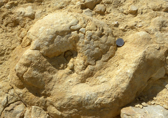
The snail is known as Bactroptyxis trachaea of the extinct Family Nerineidae in the informal group “Lower Heterobranchia” (which is still around). Cross sections of nerineids like this show their most distinctive feature: elaborate chamber walls inside the whorls of the shell (as seen in a close up below). It was once thought that these complicated structures evolved to strengthen the shell against shell-crushing predators, but now the most common view is that they held special digestive glands to enable them to exploit nutrient-poor organics on carbonate substrates (Barker, 1990).
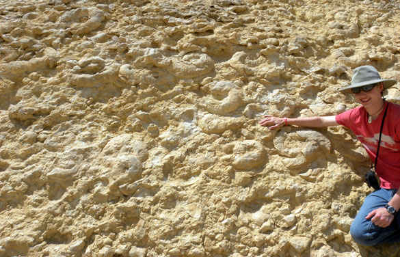
 There is another fossil type here as well: the thick, white calcareous coating of the snails. These are oncolites, a precipitate formed by cyanobacteria. The shells rolled around in a current as the bacteria added layer after layer of calcium carbonate, preserving the shells in such fine detail — and by the thousands.
Reference —
Barker, M.J., 1990. The palaeobiology of nerineacean gastropods. Historical Biology 3: 249-264.