


Guest bloggers: Adam Wood and Arjan Chahal.
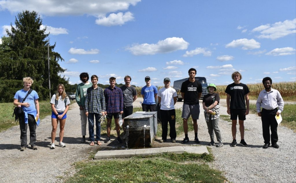
College of Wooster Hydrology team at the Airport artesian spring.
On September 8, 2025, the College of Wooster ESCI-28000-01 (Hydro) team visited two artesian wells/springs (Kinney and Wayne County Airport site). Above the group is shown taking notes on the location, the depth to bedrock, and the elevation at well head. An artesian well/spring is an spring in which water is contained within a confined aquifer and emerges from an opening freely under intense pressure. They have been used since the pre-Columbian period, and by early European settlers for accessible water. At the Airport site, tubing was placed over the artesian spring to permit members of the community to draw water into containers. This spring is used heavily by the surrounding community.
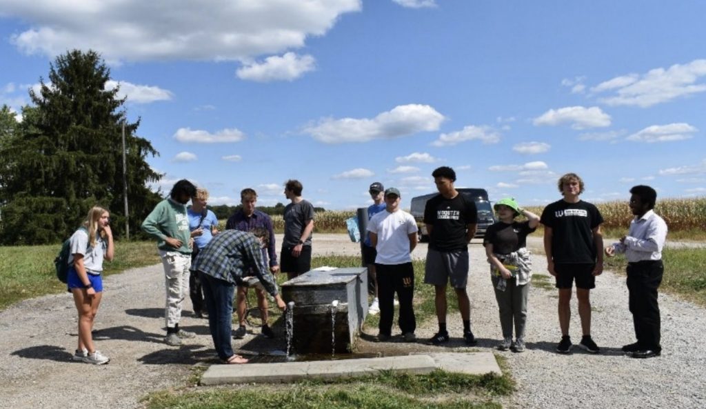
Members of the College of Wooster Hydrology team taking sips from the artesian spring.This water was perfectly potable from the source, and members of the Wooster Hydrology team even took a few sips.
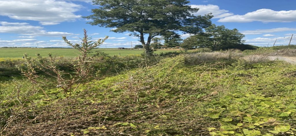
Sugar Creek at Airport site.
The stream at the airport site, otherwise known as Sugar Creek (above), is directly recharged by the artesian spring nearby, with water coming down the hill. In the distance, barely visible, is a graveyard, where sand and gravel have been laid down to prevent the stream from reaching it.
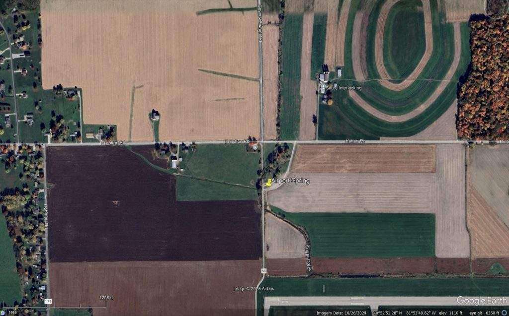
GoogleEarthPro satellite view of the Airport Spring (40.87842, -81.89743) site. Field of view ~2 kilometers.
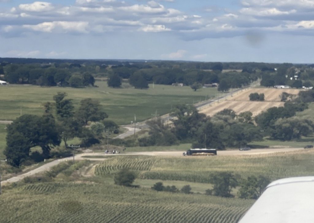
Snapshot taken from an Airplane flying over the College of Wooster Hydrology team at the artesian spring near the Wooster Airport and sugar creek. Courtesy of Neil Edmiston 26′.
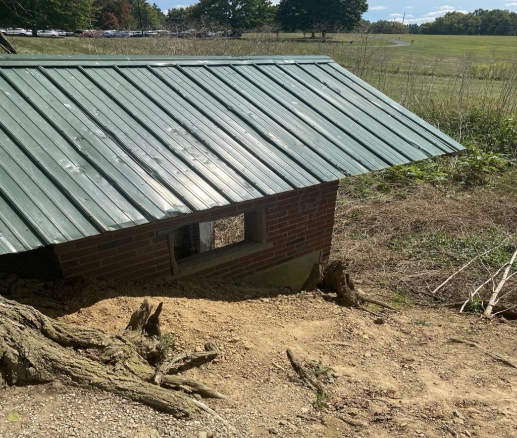
Kinney artesian spring encapsulated by shed. The Kinney artesian spring is situated at the headwaters of Christmas Run. Christmas Run flows into the confluence of both Killbuck and Apple creek. Surrounding the artesian spring is topographically hummocky land (fig. 1b), composed of an overburden of unconsolidated glacial sediment, underlain by a layer of clay. Three tests conducted by Cooper Norwell 27’ recorded temperature for the spring: 14.7o C (57.2 F), 58o F, and 59o F respectively. Whilst conducting these tests, a tile probe was inserted into the ground to measure the depth to bedrock. The tile probe will not penetrate sand or gravel, thereby indicating bedrock. Before leaving, our group technician, Nick, inserted a transducer which would collect data on the discharge (water level and temperatures) of the spring per hour.
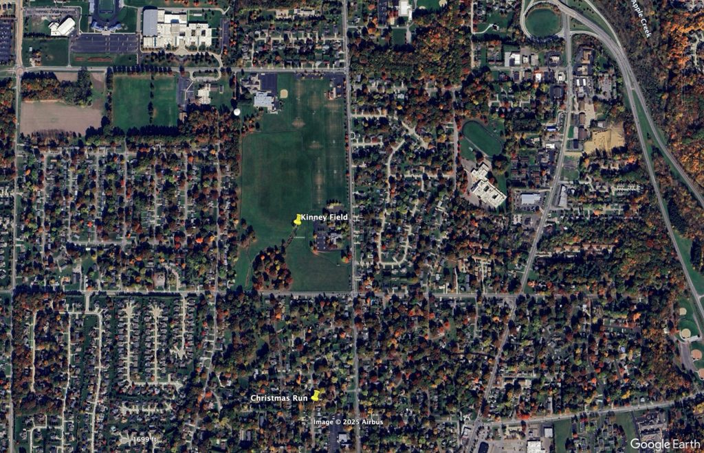
GoogleEarthPro satellite view of Kinney Spring (40.83067, -81.94129) and Christmas Run (40.825014, –81.940587). Field of view ~2 kilometers.
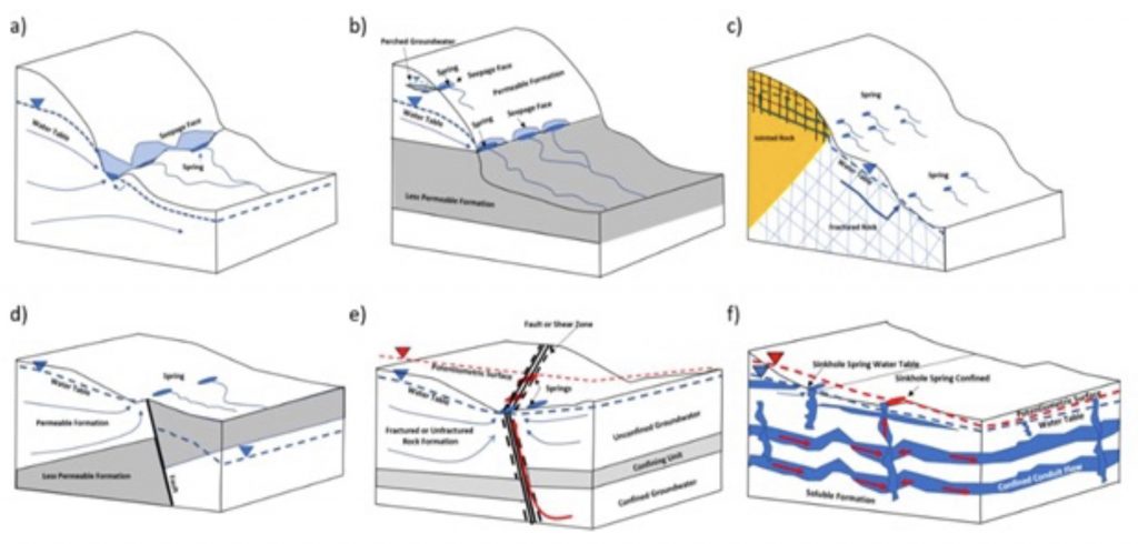
Block diagram illustrations of varying geologic settings for springs.The geologic setting most resembling what the College of Wooster Hydrology team encountered is block “b”, as the underlaying layer under the clay is composed of hard bedrock (low permeability).
I love all the HYDRO25 posts! Lots of student-driven science going on. Well done.