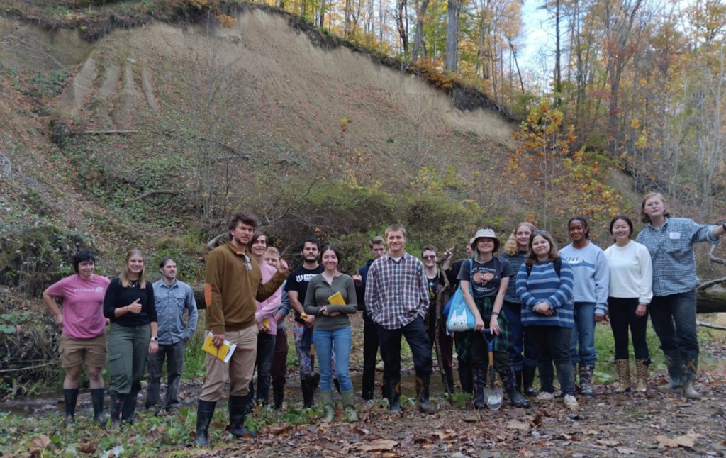
The Geomorphology (GEOM24) class posing along the Little Killbuck River Valley. Looming in the background is the delta built into Lake Killbuck during immediate post-glacial times about 14,000 years ago. The sediments are so well exposed, in part, due to some recent illegal hydraulic mining for sand and gravel.
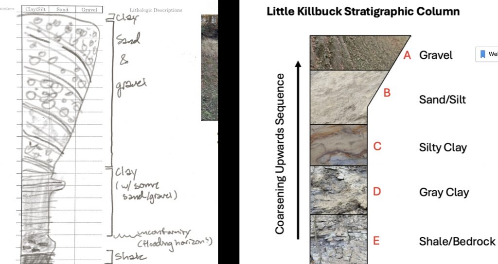
Figure 1. Two versions of the measured section showing the coarsening upward sequence of sediment making the Gilbert-type delta built into the paleolake. This sequence of unconsolidated sediments sits on the Mississippian siltstones and shales.

Figure 2. The shale is evident to the left of the class members. Clays, silts and colluvium marks the flooding of the valley and the beginning of the bottomset beds in the delta.
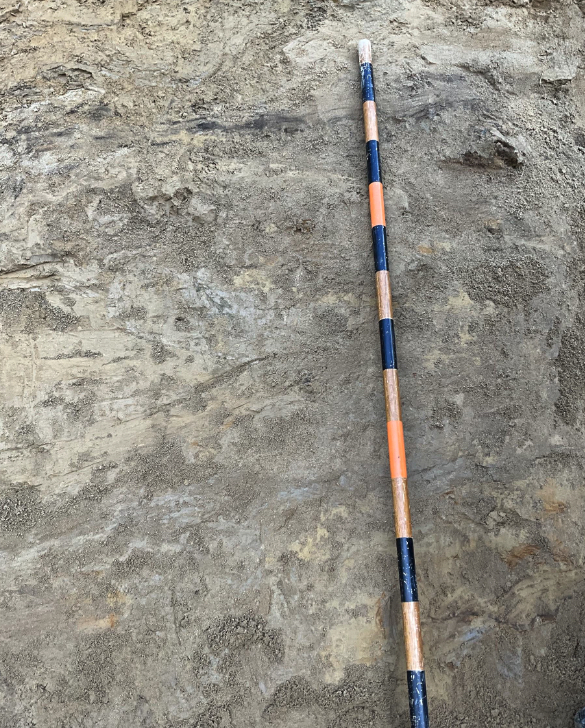
Figure 3. The foreset beds are composed to silt and sands with frequent clays and deformation reflecting changes in water levels and the high rates of sedimentation and slumping.
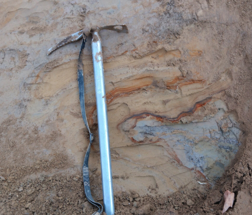
Figure 4. A “flow roll” of a mix of foreset sands and lacustrine clays likely deformed through slumping along the delta front. Note the liesegang rings in these likely 14,000 year old sediments.
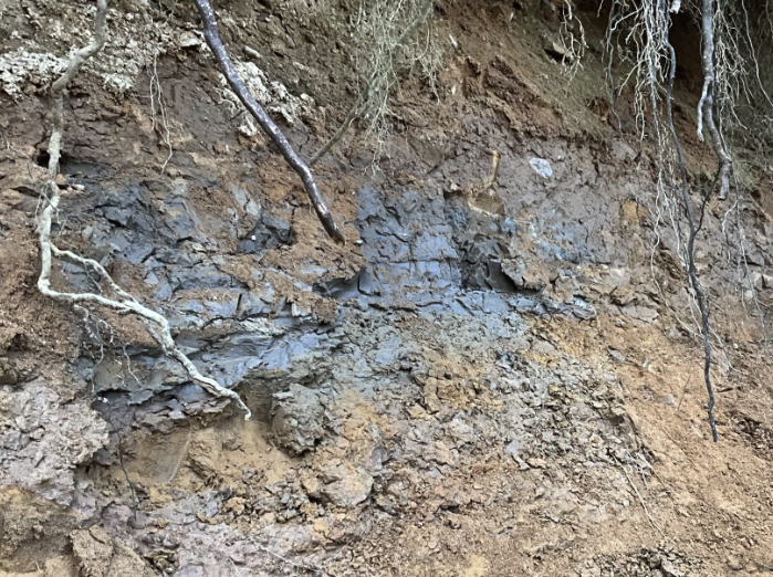
Figure 5. A somewhat enigmatic fracture clay layer is likely due to a ephemeral increase in lake level, or a change in the delta depocenter. There was some discussion of a ice readvance, however, this is unlikely.
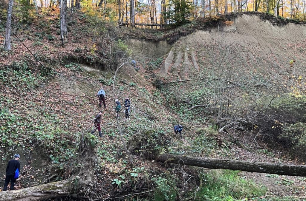
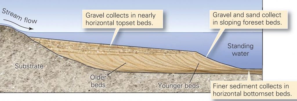
Figure 6. Front lower left to upper right – the photo captures the disconformity at the bottom, the foresets to the upper right and the cut and fill structures of the topsets. The diagram below summarizes the overall structure of the delta.
Thanks for Nick Wiesenberg for helping with logistics in all the Geomorphology fieldtrips this past semester and for digging many holes.


Such excellent geology in these posts! Great seeing the students with their hands and eyes on such sediments and rocks. Note for history that I painted that Jacob’s Staff in figure 3 in 1982! At the time I couldn’t find a staff in metric, so I made my own.