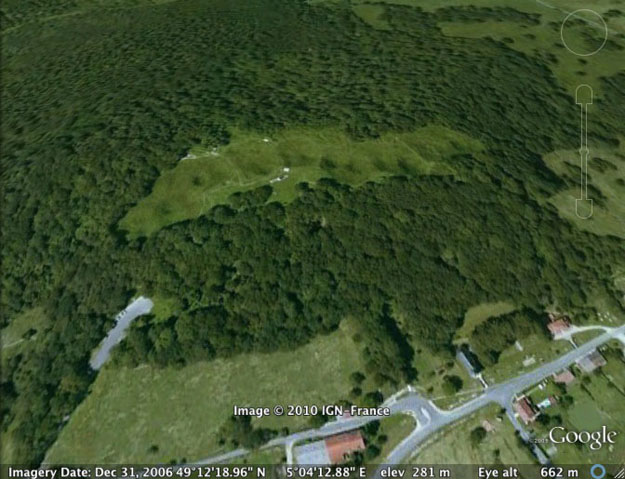
VIENNE LE CHATEAU, FRANCE–The influence of geology on war is shockingly clear on the Butte de Vauquois (N 49° 12′ 20.20”, E 5° 4′ 11.42”). This large hill (290 meters in elevation) is an outlier of the chalky detritic sandstone (silicarenite) [thanks, Jean-Claude Porchier] backbone of the Argonne Massif, with the small village of Vauquois originally on the top. (That “originally” should give you a clue to what’s coming.) It had immediate strategic value in September 1914 when the invading German Army captured it and began to shell French supply routes to Verdun running alongside the Aire River. The French desperately wanted it back.
The French Army attacked the Butte de Vauquois with thousands of men several times. Since they lacked the strategic advantage of topographic height, they suffered enormous casualties, only capturing the southern side of the hill in March 1915. The top, with its ruined village, became a no-man’s land.
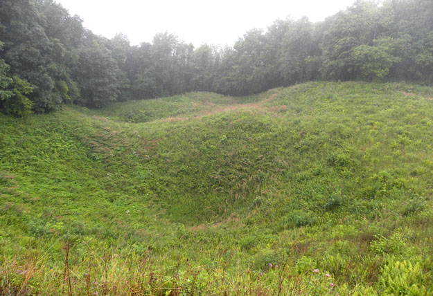
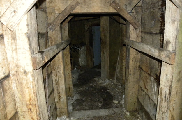
The French then began building mine tunnels through the dry and stable bedrock towards the German lines. Soldiers from coal-mining areas were employed to dig caverns underneath the German trenches. These excavations were then filled with explosives and ignited, creating massive craters on the surface which troops attempted to exploit. The Germans, who employed over 100 military geologists in their ranks, responded with their own tunnels and explosions under the French lines. Eventually almost 25 miles of tunnels riddled the Butte de Vauquois, with each side building explosive caches and attempting to intercept the enemy tunnels. An astounding 531 French and German mines were exploded here by September 1918, splitting the hill in two parts with a row of craters. The destruction was so immense that the village of Vauquois completed disappeared. Thousands of soldiers on both sides were killed here, with 8000 completely missing and presumably buried in collapsed tunnels and trenches.
This hellish underground war finally ended in September 1918 when the American First Division bypassed the hill during the first day of the Meuse-Argonne Offensive and the Germans retreated. To this day only a few of the Vauquois tunnels have been reopened. There is still much unexploded ordnance in the mines, and no one wants to disturb what has become a massive tomb.


From a French geologist.
Very good post indeed.
Please note however that the backbone of the Argonne Massif is not chalk (which would be Cenomanian) but a detritic sandstone (silicarenite) brittle enough to allow tunnelling, locally called “gaize”, from the late Albian.
Regards
JCP
Thank you very much, Jean-Claude. I’ve made the correction. Maybe on my next visit I could go with a French geologist!
The attribution of the “Gaize d’Argonne” to Albian is relatively recent. In old books and maps, you will see it attributed to Cenomanian, which is actually a chalk formation period.
Our association is setting up a geological field trip of the WW 1 battlefields at the end of May, from Flanders to Champagne.
Feel free to contact our association if you visit France.
Regards
To prepare our field trip I have created a Facebok page :
https://www.facebook.com/pages/G%C3%A9ologie-et-Grande-Guerre/685638438154306
I very much wish I could attend, Jean-Claude. I’ve just joined your Facebook page! Very interesting. Maybe later!