


 KURESSAARE, ESTONIA–The Wooster/OSU Estonia team continued to explore the Silurian section on Saaremaa Island today. It was our last day with our friend Olev Vinn, and he showed us the only remaining Silurian outcrop here I have not seen: Kübassaare Cliff in the far east of the island (N 58.43259°, E 023.30978°). The image above is the crew on the hike to the outcrop. I wanted to show some of the fantastic greens on this island as a break from the limestones!
Kübassaare Cliff exposes the Soeginina Beds of the Paadla Formation (lowermost Ludlow). Thjis was exciting for me because these are the same beds Nick Fedorchuk worked on last year during his Independent Study. The Kübassaare Clff exposures, though, are many kilometers to the east and show extensive bedding planes, enabling us to find many sedimentary and paleontological features not visible at Nick’s outcrop. You will read much more about this exposure tomorrow when we return to it for a full day of work. (Our explorations today were limited by the predictable downpour of rain.)
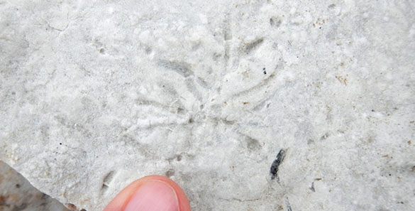 This is the trace fossil Chondrites on a bedding plane of the Soeginina beds at Kübassaare Cliff. These traces made by deposit-feeding worms are not common in shallow sequences like this, so there is a bit of a mystery here.
 The stromatolites at Kübassaare Cliff are very well preserved and visible in all three dimensions (not just cross-sections in a cliff). They do not seem to have been dolomitized like many of those in the western exposure.
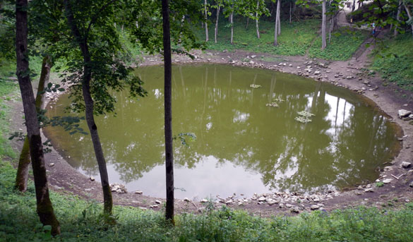 Kaali Crater is a site every geologist must visit while on Saaremaa. We stopped there on our trip back across the island.. I’ve been to the crater many times and so do not need to describe it here. It is an impressive place for the freshness of the crater walls in this very damp countryside.
 During the Bronze Age there was a structure built around the crater walls. Whether it was a fort or some kind of religious enclosure is not known. I only noticed today that there are still the remnants of a very mossy stone wall on the periphery of the crater.
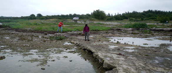 At the end of the day we returned to the southwestern coast of Saaremaa, on the Sõrve peninsula, to Kaugatuma, site of the crinoid-rich Äigu Beds (N 58.12449°, E 022.19446°). Bill and his students found some spectacular crinoid specimens, including new calices and a kind of holdfast I had not noticed before. The rain ended (mostly) and we were able to end our day rather leisurely examining this spectacular outcrop.
Tomorrow we split up for separate field localities. The Wooster geologists are returning to Kübassaare Cliff to measure and sample the section as the centerpiece of Richa’s Independent Study project; the OSU team is heading to the northern coast of Saaremaa to collect more crinoids from the Ninase Member of the Jaani Formation. We aready know it is going to rain!
Sajab vihma.
Pingback: Wooster Geologists » Blog Archive » A new Independent Study project is born: The Soeginina Beds at Kübassaare